BOOM BOOM BOLAM

It was a stressful week, and I was so very much looking forward to getting out for an overnight backpack trip on Mount Shasta on Labor Day weekend. But where would I go? Could I even do it? The smoke from fires has been particularly bad up north. Would it be too unhealthy to hike? Would the creeks on Shasta even be flowing? I had no idea. I called the Ranger station in Mt Shasta. They had no idea. Isn’t it their job to know these things?

It has not been hot enough recently. Yes, you heard me correctly. July was hot. The first part of August was hot. But the last couple weeks have been very cool. Too cool in fact. The glaciers on Shasta would not be melting very much right now. Thus I was concerned that the waterfalls would not be flowing any more for this year.

As I drove north and passed Redding, all of a sudden the smoke in the sky became horrendous. This was from the Hirz Fire. The sky was ominous. I could see the orange glow from the fire above the mountains to the east. If it was this bad at Shasta, I could forget about hiking. However, as I got closer to Shasta, the smoke dissipated and the sky became much clearer. Things were looking up. But what about the creeks? I stopped at the Whitney Creek crossing along the highway to check it out. The creek was flowing. Not super great mind you, but it was flowing. It was early morning, so it would be much better in the afternoon also. But if there is water at the Whitney Creek crossing, does that mean Bolam Creek will be flowing also? Or just Whitney? (the two creeks join together before the highway) I have seen Bolam completely dry when Whitney flows. And I have seen Bolam flowing well when Whitney is just a trickle. So what would it be like today? The only way to find this out is to hike all the way up to Bolam Creek as I had originally planned.

I have hiked up to Bolam Creek Falls before, but did not get to the upper or middle falls. It was a killer hike just to the lower falls, and I had no energy or time to continue up the mountain. This time around, I planned a different route. A much easier route, and I would be camping at Bolam Creek as well. I would have plenty of time. It was going to be glorious.

It was a beautiful day. I was feeling so refreshed as I started this hike, but my pack was very heavy. I was carrying 3 1/2 L of water, which should be enough (hopefully) to get me up there and back. I was not certain what the water situation would be up at Bolam Creek or if it would even be flowing, or if it was flowing could I even get down to it? If you look at Google Earth it does not look possible to get down to creek level. The canyon is seriously steep. So that meant I had better take enough water with me to be safe and not sorry.

The trail starts out well for the first 3 1/2 miles. It is well-traveled and a gentle grade, climbing up 1500 feet of elevation. 99% of the people using this trail are summiting Mount Shasta or trying to anyway. But not me. I am looking for waterfalls. So when the trail ends at the point where the climbers go upwards and onwards, I needed to go cross country over to Bolam creek. It was fairly easy going.

The geology on this side of Mount Shasta is fascinating. I crossed over a number of very old and very dry drainages. These are not marked on any maps. They looked to be volcanic, or glacial, or both. At least a couple for certain were obviously glacial. Glaciers that have long since disappeared, probably hundreds of years before USGS made its topographic maps. It seems to me that some people forget that glaciers have been melting pretty much continually since the last ice age, thousands of years ago. If they are continually melting, then they will eventually all disappear, right? Are they melting faster now? Perhaps they are, but it should not be a surprise to anyone that glaciers are melting. On Mount Shasta, the Coquette Creek drainage is dead (very sadly). I declared it dead two years ago after I came up to visit Bolam Falls. I do not think this waterfall has flowed significantly or at all in over 10 years. What a shame. However, it is not surprising. There is not enough glacier above to melt into this drainage anymore. I would pay a lot of money to travel back in time and see Coquette Falls flowing as it once did. But the Bolam Creek drainage still flows.

I descended down into the Coquette drainage, the first real steep section of my hike (which I would have to come back up the next day), crossed it at the dry waterfall and made my way over to Upper Bolam Creek Falls. There was a perfect campsite right beside the waterfall viewpoint, with a view of Mount Shasta and the waterfall in one shot. What a perfect place. I was so happy. I set up camp, had my dinner, then decided what to do next. I had thoughts of crossing over Bolam Creek to Whitney Creek, but I could see no way across. The canyon was crazy steep on both sides. I decided to just stay at Bolam and I’m glad I did.

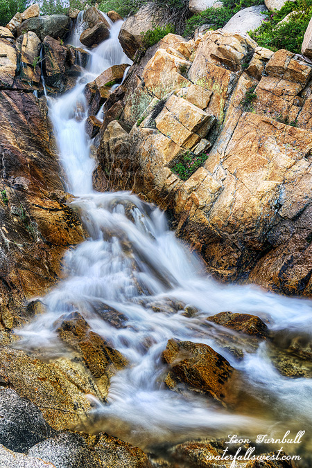
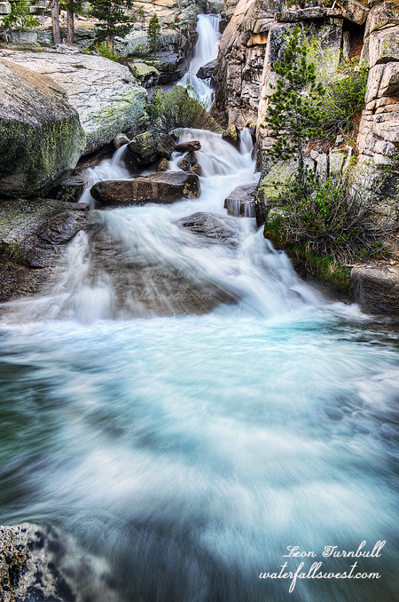
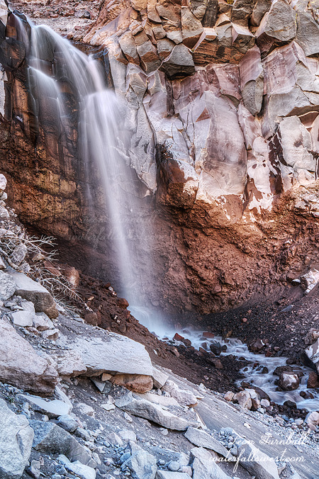
In the evening I went down or tried to get down the Coquette drainage to get to the base of Bolam Falls, but it was too steep, the ground was very unstable and crumbly. Nonetheless, I did find a path over to it, after I had almost given up. It was awesome to be up close to this marvelous 80 ft. high waterfall (pictured here above). After this I climbed back up, got down to the middle falls (which was crazy steep and dangerous- but I managed), and then photographed the upper Falls from top of the ridge.

I was now down to a half liter of water. I still had found no way to get down to the creek level at any place. The creek was also flowing incredibly dirty and it was not really drinkable. So what would I do? A half liter would not get me back to my car. I went to sleep, very dirty, and very tired. In the morning I decided I’d have to get down to the creek. I found a way, and filtered some water. The creek flow was much lower in the morning, and also a lot cleaner as well. Now I had plenty, and even enough to enjoy a cup of coffee with my breakfast. It was a beautiful morning, and I was feeling terrific. After breakfast, I packed up the gear and headed back up the hill (and then entirely downhill after that initial tough ascent from Coquette). It was a fantastic couple of days in the Shasta Wilderness.


No Comments

OVERCOME

It is summer. Hot, muggy, mosquitoes, and now smoke from fires. It must be California.

It also means it is time for my annual trip to Horsetail Falls. Horsetail is the only waterfall around here that flows well late in the summer. There are not many mosquitoes here either. And it was warm but not overly hot up in the mountains. That just leaves the smoke, but surprisingly, when I arrived at the trail head it was not that smoky at all. There was a bit of haze but not too bad at all.

It was Friday. I left after work. The traffic was horrendous. There was a truck along the highway that was completely incinerated. Traffic was backed up for miles. Fortunately, the firefighters got the fire out. This is somewhat similar to how the Carr fire got started. I almost turned back because of the traffic but I continued on.

So I arrived at the trail head later than I hoped, but I did not rush on the hike because I was taking a video along the way. There was no one on the trail, which is the nice thing about coming on Friday evening. I got up to the bottom of the lower Falls at about 6:45. The waterfall was flowing quite a bit better than I expected it to be. I took some quick photos and decided how I would accomplish my next feat.

I have been up to the top of Horsetail Falls a number of times of course, but the last two or three times I have had to turn back. There is one very steep and slick section just above the lower waterfall. It is freaky. I think that in my old age it has just psyched me out too much. All you young bucks have no trouble I’m sure. Anyhow, this time around I managed to squeeze and squeeze and wedge myself up through a crack to get on top of the ledge above the slick granite. I made it! I was in shock because I was not expecting to make it up. I wondered what I should do next. This was a big major mental obstacle for me to overcome. Now I am confident I can do the same thing again in the future. I was feeling ecstatic.

The thing I wanted to do next is get over to the bottom of the upper tier of Horsetail Falls. I have never been to the spot before and have wanted to do it for quite a while. Once above that slick ledge, it was pretty easy-going. There were a few big rocks to walk over and some brush to go through but I made it over to the base of the huge cascade. So Awesome!

It was now very late in the day. I had very little time to take photos and video and get back down the mountain, and I did not want to go back down that ledge in the dark. Thus I did not spend much time here at the upper tier, not nearly as much as I wanted to, but I took my photos and left. Going down that ledge is much easier than going up.

It was after sunset when I got to the bottom of the lower Falls. I still had to hike down to the trail head which is another 45 minutes. The entire hike was in the dark. But I did not mind, I had my headlamp, and it was an awesome experience at the Falls today.

Even with my headlamp, it was very difficult to make out the trail because there were particles in the air making it hard to see. I don’t know if it was just dust, or smoke particles. I think it was the latter, but as I said the smoke was not bad at all. Thus it was not surprising when I tripped over a root (or ruut as Americans “think” that Canadians say) and landed in the dirt. No harm done, just a dirty leg. All in all, totally worth it for this short hike to Horsetail Falls in the Desolation Wilderness.


No Comments

FUTURE PONDERINGS

This is Silverlace Falls, about 30 ft. high. I camped here on my first night in the Yosemite Wilderness in June. It is a fascinating little slide on the Merced River but difficult to photograph because it is so wide. I did not have a super wide angle lens, which would have been nice. I still have not processed all my photos from the Yosemite trip, so you can still look forward to seeing more pics in the coming weeks.

This time of year (ie. Summer), I start to get very anxious about what the future may hold for next season. Will we have a good winter? Will we see another drought? It is already time to be praying for next year. In 2018, we had a weak La Nina, and as you know, we had a below average winter. The precipitation was about 80% of average for north and central California; the snow pack was only 50-60% of average in California. We also had a weak La Nina in 2017, but of course that was a huge year for us.

So what about 2019? It looks like we are going to have another El Nino next year, but before you get all excited (some people seem to always get excited when El Nino is mentioned), this will not be a strong El Nino. It looks like it will be a weak El Nino (possibly a moderate one). And what does a weak El Nino mean for snow fall next year? You should all know by now it does not mean anything! Remember that super strong El Nino we had a couple years ago and ALL the forecasters said we were going to have a huge year – but instead we only had an average winter that year (or just very slightly above average). Nonetheless, with that caveat in mind, I still like looking at historical events. We have had 11 weak El Ninos since 1950, and 5 of those were above average winters, 2 were average, and 4 were below average. Digging deeper, only one weak El Nino followed a weak La Nina event. That one was a below average winter. Six of the weak El Ninos followed a below average winter (what we just had), and four of those six gave us above average winters. For the moderate El Ninos, 3 out of 6 were above average. So as I said, it all means nothing! It seems to me, we have a 50 percent chance of a good winter in 2019. In other words, please pray!

No Comments

MARMOTS AND MOUNTAIN TOPS

I am not one who normally likes to climb mountain peaks. Before this past week, I can only think of one mountain I have climbed in the past few years. I will climb up mountains, with or without a trail, with or without cliffs, in order to get to a waterfall. But waterfalls do not exist at the very top of mountains. Right? So what is the point in climbing a mountain? It is too much hard work!

Nonetheless, on July 4, I had a stupendously great idea: climb to the top of Pyramid Peak. At 9983 ft., it is the highest mountain in the Desolation Wilderness, and third highest in the Lake Tahoe area. Along the way, I would stop at a new waterfall that I had not seen before. It was going to be an epic day!

It is not an easy hike to the top of Pyramid Peak. There is no defined trail, and I would be going the long way up. There are three main “routes” to the top (no “trails”). The one I chose was the longest route, 6.1 miles, but also the easiest (supposedly), with the least amount of elevation gain (3300 ft. in total). The main reason I chose this route was because of the waterfall.

I started hiking before sunrise. I wanted to get to that waterfall first, before the sun. It was almost five miles to the falls. I hiked quickly. Thankfully, these five miles are somewhat tame in elevation gain (and this first 5 miles was also on a defined trail). The hard part would come later.

Along the way, I came across a bear. It was the first bear I have seen this year! Considering that I have backpacked in a number of wilderness areas this year, including the bear haven of Yosemite National Park, it is surprising I have not seen any bears yet. Technically, I was not even in the wilderness yet when I saw this one. But I was happy! A great start to my epic day. I got within 20 feet of the bear before either of us saw each other. Then he took off like a scalded cat. I only saw his big brown behind.

I came to the waterfall just a little before the sun. Not really a great waterfall but it was pretty and it was over the minimum 20 ft. high. I took some photos then psyched myself up for the upcoming tough part of the hike. I still had 2000 more feet to climb in about a mile. In case you are wondering, that is a lot!

From Lake Sylvia, there is, supposedly, an obvious notch that you need to climb up to get up on the ridge leading up to Pyramid Peak. It is, supposedly, not very difficult to climb up. I could see the notch. It looked horrifically steep and cliffy! Well, I worked my way over to the bottom of it. I could see a path going up a secondary notch. This must be the correct way. People have obviously gone up here before. The other notch would be far too cliffy. I started up. Before long, however, the path became incredibly steep, crumbly, and dangerous. But this must be the correct way! I hemmed and hawed for a long time, then decided to turn around and go back. It was too steep. A fall here could easily result in broken bones, if nothing worse. So now what? Do I go back home?

Before doing that, I decided to go over to the other notch, although I was sure it would be far worse. However, when I got over to it, I saw a well defined path going up the mountain. This was the proper trail! It was not too steep or dangerous. It was pretty easy (except that you are climbing up a mountain with lots of elevation gain). I got up to the ridge in short order. Now I just to climb up the ridge to the top. There was still 1400 ft. of elevation gain to go, now much less than a mile. It was very slow and took a long time. The last section was a jumble of huge rocks that you needed to climb up. I found it very fascinating, obviously volcanic in origin, but it was not easy to climb up (or down). However, the marmots sure must love all these rocks. There were a lot of them around, especially at the top. I got lots of video of them ( so watch for my upcoming video of this hike).

I was not the first one to the peak. In fact, there were a lot of other people climbing up Pyramid Peak on July 4. No doubt because it was a holiday, this was the reason. I would have liked to have some alone time on the peak for a while. If I had not messed around for 45 minutes trying to climb up that other notch, I would have been the first to the top. Ugh. Oh well. I took my time at the top, had my lunch with the marmots, and of course took some photos. There was a lot of haze from the fires in California (one big fire, anyway). I could see Lake Tahoe, barely, off in the distance through the haze.

A trio of East Indian guys came up while I was eating. It was a bit funny because they totally freaked out when they saw the marmots. They thought they were skunks, or some other dangerous animal. I reassured them that marmots were harmless, but just keep an eye on their food. Ha! After saying that, one of the marmots jumped on one of the guys’ head. Kidding! But seriously, did I ever tell you about the marmot that tried to kill my daughter when she was a baby? A story for another time. (ok, it did not actually try to “kill” her, exactly).

Well, time to go back down the mountain. It was a long 6 miles back to the car. The steep part down to Lake Sylvia I found to be very hard on my knees, but after that it  was a nice gentle downhill. Except that I ran out of water three miles from the car. I had brought 3 liters, but it was all gone. I could have filled up in the creek in an emergency, but decided to just get back to the car as soon as possible, where I had plenty of water waiting for me. I was very tired when I got back to the car. Hopefully, I would sleep well that night, but it would be difficult with all the fireworks going off on our street. I still had to go to work the next day too, but it was an epic day in the Desolation Wilderness.


No Comments

THE BAD SEASON

This is 40 ft. high Merced Peak Falls in Yosemite. It is quite lovely and fairly easy to get up close to it.

Now that it is summer and the mosquitoes have arrived, I am done with hiking. Or am I? I do not usually hike much in the summer because of the heat and the mosquitoes, both of which I hate absolutely. With the low snow pack this year, the waterfalls are not going to be flowing throughout the summer either (unlike the last two years), so what is the point in torturing myself? I don’t know, I am sure I will go on a hike or two, but I will not be backpacking again until September.

I thought I did really well this year with my backpacking trips. Much better than last year. I went on six backpacking trips this winter/spring, and five of them were successful (in terms of seeing waterfalls). That is definitely a huge accomplishment.

So see you all in the Fall. But seriously, I still have tons of photos to process from my last 3 trips. So even if I am not hiking much, you still have those to look forward to. Ha ha.

No Comments