DAY 3. TO DIE IS GAIN

(Philippians 1:21)

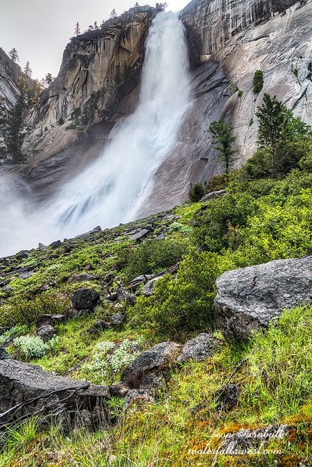
I mentioned that I saw a number of waterfalls on the Merced River. Some of these are marked waterfalls. At least one of those marked waterfalls is not even 20 ft. high, and should not even be called a waterfall. There are others, however, that are not marked, and some of those are well over 20 ft. high. Nothing huge, but definitely waterfall worthy. Why are they not considered waterfalls by the National Park Service? Some of these unmarked falls are out of reach, some were not very photogenic, and some were in horrible harsh light so I did not take any photos. This one, though, I thought was a really good one, and I was able to get to it in the morning when the light was still good. It is about 30 ft. high, and is a powerful little thing. It was so misty at the base of the falls that it was practically impossible to take photos. Nonetheless, I did take a photo of it.

After photographing the falls, I ate my breakfast here. I did not doddle. I had a long hike ahead of me. It was going to be a 21+ mile hike back to the Happy Isles trailhead. It would be a very long day. I was going to die.

I am not positive but I do not think I’ve ever hiked 21 miles in a day before (though I’ve come close). I was certain, though, that I could hike that distance today because it was all downhill. No problem. It was not quite “all” downhill, however. There was one uphill section that I knew about beforehand and I was mentally prepared for it – about 100 ft. in elevation gain after passing through Echo Valley. However, there were a number of other “little” up hills that I definitely did not remember seeing on the way up. These ones killed me. I was not ready for them. They should not be there. It is supposed to be all downhill hiking. The two worst sections were just before the top of Nevada Falls, and then right at the end of the hike below Vernal Falls. I almost died. Literally.

I thought I made very good time to the top of Nevada Falls. After this point, the hike is excruciatingly slow going. There are two reasons: One, there are hundreds of people on the trail. There are many narrow spots where you must go in single file, so you need to wait for the people coming up the trail before you can proceed. Also, it is not always easy to pass slow people going down. You need to wait for a wide enough place, or hope they step aside so you can pass them. I always try to descend from Nevada Falls as fast as I can, even though I am very tired by this point. This brings us to the second reason: the terrain is very steep, rocky, and with many awful steps cut into the rock. It is awfully slow going down. It just takes a very long time.

I finally got back to the car beat tired. It was 3PM. Not too bad, overall, for a 21 mile hike. I started at 5:30AM. It took more than one full hour to exit Yosemite Valley. The traffic was totally ridiculous. They did something to the roads in the Valley, re-routing or re-arranging them. I swear they made things 1000 times worse than they were before. What genius decided this? It has never been so slow driving around Yosemite Valley.  Even last year, though it was horribly busy, it was not as bad as this year. It is just so stupid now. It does not make me want to ever go back to Yosemite (but of course, I will).

I finally got to Groveland and stopped at Pizza Factory as I always do after my Yosemite hikes. I was absolutely starving. Bless the Lord, they were not busy. I ate my fill of pizza and garlic bread, and then made the long drive back home. I may have almost died on the long hike back, but it was worth everything. It was a great few days in the Yosemite Wilderness.


No Comments

DAY 2. TRIPLE WHOPPER

I got up very early in the dark because I wanted to get to a couple waterfalls up the trail on the Merced River before the sun. That is about 4.5 miles in a couple hours. I made it but I screwed up on the first one. I had set my ISO very high and forgot to turn it back. Ugh. I do hope that picture still turns out ok. The second falls was only 12 ft. high, so that was a bit disappointing. I would not even call it a waterfall, but the park service calls it a waterfall. I found some other waterfalls on the Merced River that were much bigger and yet the NPS does not recognize them. More on that later.

After that initial rush, I could finally relax. I ate my breakfast at the second falls, and tended to the blisters on my foot. I stayed an hour at the small 12 foot waterfall, watching the birds play in the river.

From here I only had four more miles to hike on this day. I arrived at my campsite by 10AM. All I can say is WOW.  At its source, the Merced River has three main forks that come together. All three have waterfalls. The biggest fork is the Triple Peak Fork and this has the biggest waterfall. It is a monster waterfall. It is almost 600 feet high (my calculation is 585 ft. high). That makes it just oh so slightly smaller than Nevada Falls (officially 594 ft.), and thus easily the second biggest waterfall on the Merced River. Unofficially, I believe the NPS measurement of Nevada Falls is incorrect, and that would mean Triple Peak is actually the biggest waterfall on the Merced. Anyhow, Triple Peak was flowing magnificently. It was absolutely stunning. I had only seen one photo of it before and that was at low flow. At high flow, it is incredible.

It is also very difficult to photograph. Although you can see the entire waterfall, it is blocked by many trees, and is not photograph-able from any single viewpoint. That means I had to photograph it in sections. This was difficult because it is in the sun for most of the day, so I could not even get to all the sections before it got dark, but I got to the main ones anyway.

Now to find a campsite. I wanted to camp as close to the waterfall as possible. There was one big problem today: mosquitoes.  There was not much of a breeze. It came and went. When the breeze stopped, the mosquitoes would come attack me immediately. When the breeze started again, I had a bit of relief. There were more mosquitoes closer to the falls so I tried to pick a spot further back that was more open and had a bit more breeze. The only trouble was that the ground was uneven. I would have a lumpy sleep tonight. Was it worth it? In my opinion, anything is worth enduring if it means less mosquitoes.

It was still early in the day. What would I do all day? I decided to climb to the top of the falls (500 ft. climb up the mountain) to see what it was like, and to see how long it would take. The top of the falls is about a 80 ft. drop, and it was spectacular, well worth photographing from up there. So … that meant I would have to go back down to camp, then climb back up to the top a SECOND time, later that evening. Talk about cruel and unusual punishment. Some people might say that, but to me it was worth the effort. So I went back down the mountain to my campsite, lounged about all afternoon, waiting for evening to come.

Finally it came. Yet I was still too early. I had to wait an hour at the top of the falls for the sun to go down behind the mountains. It was also far more misty at the top than it was at noon. The flow in the waterfall was noticeably much stronger due to snow melt from the day. My calculations were also off. I calculated that the falls would be in shade by 7:30PM. That would give me “just” enough time to go down, photograph the middle tier, and then retreat back to camp before dark. It was 7:40PM and the top of the falls was still in the sun. I could not wait any longer. I had to photograph it now. After doing this, I ran down the mountain (which was difficult because it was very rocky), made it over to the middle tier (shown here), then ran back to camp. I got back just in time, got ready for bed quickly, and went to sleep. It may have been a lumpy sleep, but I slept.

No Comments

DAY 1. IF I LEFT THE ZOO

(FYI, the title is from a Jars of Clay album)

I reserved my wilderness permit for Yosemite 6 months earlier. It is just a bit difficult to know 6 months in advance what the snow pack and weather are going to be like, but that is the way of it in Yosemite. If you want to get a permit for Yosemite National Park, this is what you need to do. You can always try to get a walk up permit, but do you really want to drive 300 miles and take a chance that you may or may not be able to get a permit? Some may not mind doing this, but it is not for me.

Assuming we would have an average snow pack, I reserved June 7-9, which seemed like a good time to do this hike. However, of course, we had a below average snow year. The snow is still melting in the mountains, though, and the rivers are still very high, thanks to the “miracle” March (and God). Nonetheless, ideally, I would have liked to do this hike 2 or 3 weeks earlier, mostly because the mosquitoes would be out by early June this year. I was hoping they would not be a big problem (yet). The weather was looking good. There was a delta breeze and the weather was on the cool side (not too hot); hopefully there would be a breeze in the mountains to keep the skeeters at bay, at least a little bit. All in all, June 7-9 was looking like a good weekend for a backpacking trip in Yosemite. I did good reserving 6 months in advance.

I arrived in Yosemite the day before my scheduled hike, picked up my permit, got my campsite (outside the park), and got my dinner in Groveland. I would get a very early start the next morning. I spent the evening at Rainbow Pool, watching a bunch of kids jump off the cliff. There were even some kids less than 10 years old jumping. I sure would not have let my kids jump off that cliff at such an early age! The cliff is about 30 feet high. The river is strong, and there could be an undertow at the falls. Some of the kids were jumping directly into the waterfall base, I don’t know, it seemed a bit dangerous to me, but I did not witness any casualties. After I had seen enough of this, I went down to the lower falls. It amazes me that there are so many people at Rainbow Pool, but no one ever goes down to the lower falls, which is hundreds of times better. It was early and I thought it would still be in the sun, so I did not even bring my camera. As it turned out, the falls were already in the shade. I should have brought it after all. Well, I just took some iPhone pics instead, and relaxed. It was a nice evening.

The next morning, I got to the Happy Isles trailhead at sunrise to begin my big hike. The zoo had already begun! There were already lots of people on the trail. This early! On a weekday! I could not believe it. I was hoping to be alone or mostly alone on the trail this morning. I was not expecting to see so many people this early. Who hikes this early? Besides me? I was upset. I think most of them were hiking Half Dome. It makes sense you would want an early start for that hike. If I had thought about that, I could have started my hike 30 minutes or more earlier than I did. Ugh.

One thing I wanted to do which I have not done before, is to approach Nevada Falls from the other side. I have only seen one other photo of Nevada from this side before. Everyone goes to Nevada on the trail. No ones goes off trail to Nevada Falls on the south side. It must be unbelievably difficult to get up to Nevada on the other side. Surely. Horrible. Well, it took awhile, but I managed to get up to Nevada Falls. It was amazing. It was also incredibly misty. How was I going to photograph this beast? It was wet everywhere. I found one spot that was not too bad, and took a few photos. Then I enjoyed the mist and experience of this incredible waterfall from up close before heading back down to the trail proper. As I was getting ready to leave, I dropped my camera. It landed directly on a rock. The lens hit the rock first. Oh damn. I thought it was done for. I would have to just go on back home. What would be the point of backpacking up to awesome waterfalls if I could not take any photos? Thankfully (and praise God), only the side of the lens hit the rock. Part of the side broke off, but the lens itself was untouched, and I managed to re-attach the side piece even though part of it was broken. The camera was still in perfect functioning order. Whew!

Back on the main trail, eventually I left the zoo and all the other hikers behind me, once I got past Little Yosemite Valley. I was alone, finally, just the way I like it. I saw a couple other backpackers coming down the trail, and I saw a few campers at Merced Lake, but above Merced Lake, I saw absolutely NO ONE for the entire weekend. It was fantastic. It was perfect. Actually, I was not expecting that. This is YOSEMITE after all.

I had hopes of hiking a lot further up the valley than I ended up actually hiking on the first day. It is a very tough 12 miles and 3000 ft. elevation gain to Echo Valley. I was beat. I was dead tired. I had to stop. I must stop. But where can I stop? In Echo Valley, there would be mosquitoes everywhere. (and there was). I continued on and came to Silverlace Falls. I found a nice spot at the top of the waterfall. It was open, there was a nice breeze, and there were no mosquitoes. I setup camp here, had dinner, then went to photograph some falls in the evening, including Silverlace. Day one was in the books.

No Comments

DAY 3. WELCOME TO THE JUNGLE

We had no mosquitoes (or very few) in West Cherry Creek Canyon. I think we hit this area at the perfect time. Everything was about to change.

We woke up fairly early, had our breakfast, and packed up camp. We had about 9 miles to hike. The temperature had skyrocketed. It would be a hot day hiking back to the trailhead, and it was best to do it in the morning.

We had one visitor at our campsite in the morning, a marmot. He was hanging out on a log by our tent, not paying much attention to us, and drinking my pee. Well actually, I think he was eating ants on the log, but it was the same place where I had been peeing. Flavored protein?

In the two days we were there, we saw no one else in West Cherry Creek Canyon. We had it all to ourselves. That is another reason it was so awesome. Being all alone in the wilderness, with no other human being within miles of you, I find that so refreshing. All that would change on the hike back, however. We saw tons of other day hikers and backpackers on the trail, on the last half of the hike especially. It was ridiculous. Most of them were not going to West Cherry Creek, likely, but still it was crazy busy.

Another thing: mosquitoes! We came to the Piute Creek crossing and all of a sudden, the mosquitoes were a force to be reckoned with. Up to that point, none. Piute Creek and from there to the end of the hike, they were all over the place. There was one backpacker we saw at Piute Creek, who said he had camped there that night, and was eaten alive. Half his arm was missing. I told him to go to West Cherry Creek. There were no buggers there. I think he was going to do it. After he applied the necessary first aid to re-attach what was left of his arm.

Five hours after we started, we arrived at the trailhead. It was hot. We were tired. But we made it. We had a glorious 3 days in West Cherry Creek Canyon. (I did, anyway).

No Comments

DAY 2. CHERRY ON TOP

There was no sun at our camp in the morning. It would take awhile for the sun to penetrate those granite walls. Thus, it was very cold in the morning. We took our time eating breakfast, and packing up our camp.

It would be an easy day. We only had to hike 3 miles back to the top of the canyon. Jadon should have been much happier today. He was not. Not that he complained, but he was not enjoying himself. He was probably bored too. We got to camp before noon, then had nothing to do all afternoon, so we napped and played cards.

At around noon, I tried crossing West Cherry Creek (while Jadon waited in camp). You would think it would be utterly impossible. The inflow to Cherry Lake was about 700 cfs. West Cherry gets about half that flow, so 350 cfs. That is certainly not crossable, but right at the trail crossing, the creek splits into five separate channels, so about 70 each? But at noon, it is much less than that as well. So in other words, I crossed the creek easily. It was up to my knees, and there was a strong pull, and it was freezing cold, but it was crossable. I explored the other side of the creek, and I came up with a plan for the evening. It was a darn good plan, but sometimes plans go awry.

You see, I was 90 percent sure that we could not get to the upper falls on the near side of the creek (where we were camped). There is a granite cliff that comes down from Piute Lake right to the creek, and the main part of the waterfall is around the corner, out of sight. I was certain we would not be able to get around that corner. However, on the other side of the creek, as I explored, I could see the upper falls, and it looked easy to get up to see it. So the plan was to cross the creek in the evening, and go up to the falls on the other side.

However, one problem: in the five hours since I crossed the creek at noon, the creek level had now risen by about one foot (perhaps a bit less) due to snow melt from the heat of the day, and it was now uncrossable! It was crazy how much it had risen, and it was far too risky to cross it now. I figured I could just try it again in the morning. We decided to climb up the creek on this side and see how far we could get. Well as it turned out, this was a better plan anyway! Getting around the corner was actually very easy, and we came up to the main section of the falls, a majestic two tiered waterfall about 70 ft. high. It was a glorious spot (and much better than it would have been on the other side of the creek). I was very happy, and I would not have to cross the creek in the morning. Sleeping in was a much better option now. Yeah, now that is a good plan.

No Comments