Waterfalls, waterfalls, so many waterfalls. I found so many waterfalls on this creek, I could not count them all. They were like sand on the seashore. Well ok, not quite. I am not a very good counter. There are, in fact, seven significant waterfalls on this creek (I can count to seven, I think). Do you want to know where they are? Access to all of them is mostly not very difficult. You can see my website for details, it will be updated very soon, and in fact the first page is ready: here
I just want to remind everyone out there that although I love sharing my photos and stories on Facebook, Instagram, and on this blog, the reason I do so is to direct you to my website waterfallswest.com, where you will find tons of information: detailed directions, descriptions, maps, photos, downloadable trail routes to put in your GPS, and much more. “I do all the work so you do not have to”. That should be my new motto. Perhaps someone else has already used that one. If you already are a subscriber to my website, thank you so much, but if not: my website subscription is only $20 per year; that is not very much money if you think about it, it is an awesome deal. It is less than buying a magazine subscription or a book, and I have loads more information on my website than any waterfall book out there. Why would you not want to pay a small fee to obtain this easy information? You could perhaps, if you are diligent, find some of my waterfalls on your own if you know where to look, but you won’t be able to find a very good percentage of them. Remember: “I do all the work so you do not have to”, and I continually add new waterfalls to my site, usually weekly or every other week at least. Like this one here, for example. You won’t find this one in any book or other site.
It is a very long drive out to this location, and I had initially thought there would only be one or two waterfalls on this creek, so my plan was to do a quick hike up this creek, then go to a couple different creeks before heading back home. However, when I arrived and started the hike, I realized there was much more to this creek than I first thought. I quickly made the golden decision: explore this creek as fully as possible, and forget about the other creeks this time around. Even so, I was not able to finish exploring the creek, there is just so much here. I guess I’m just going to have to come back someday. How awful is that going to be! Not!!
The creek had good amount of flow in it. Unfortunately, that is a very bad thing because it means the snow is melting. Snow should not be melting in February! Isn’t that a law? Apparently God has not gotten that memo. Although we had a very good December and January this year, February has gotten off to a horrendous start. The snowpack is dropping like a dead bird. We are in the second week now and nothing in the forecast until at least the end of next week. Hopefully, after that, we will see a big positive change. Maybe. Please?
When I came up to the first waterfalls on the creek, I was thinking oh gee, I’m so giddy I don’t know what to do with myself. These waterfalls should not be here. I knew, however, that there were (or should be) bigger ones still ahead, so I decided I would keep going and come back to these lower ones later. I was afraid the upper waterfalls might get into the sun earlier than the lower ones, however it turned out to be the other way around. Doh! Another reason to come back again, someday.
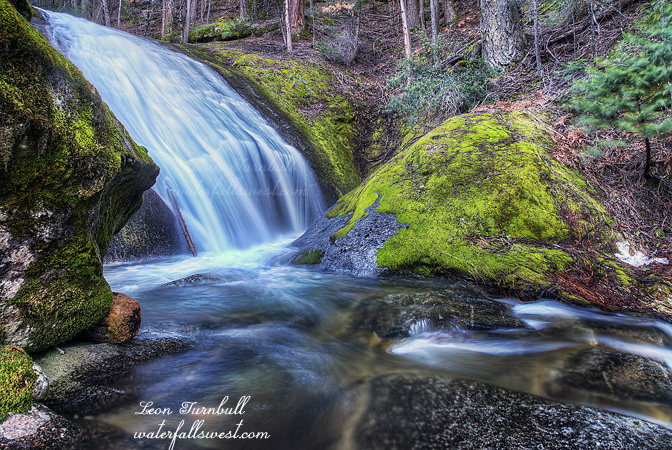
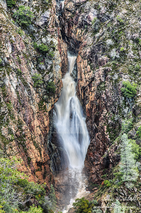
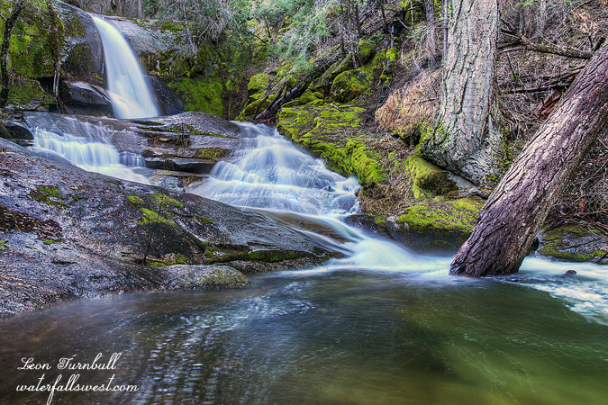
None of the waterfalls are huge ones, but they are all nice and all > 20 ft high. The biggest one on the creek is this one shown here and it is 50 ft. high, a magnificent 33 ft. plunge, followed by a 17 ft. slide. It is certainly the most impressive of all the falls, though not the prettiest.
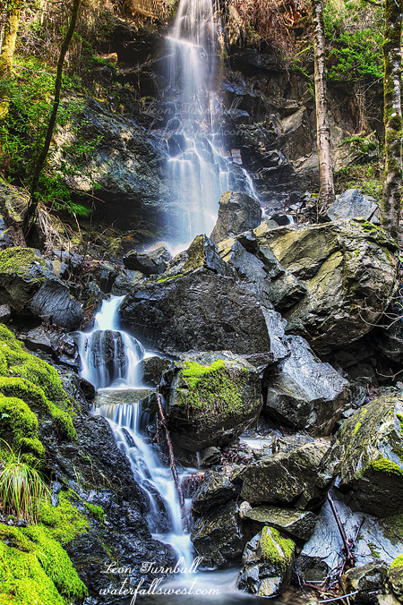
I continued climbing up the canyon above this waterfall, thinking I would not find any more falls. Wrong again. The hits just keep on coming. Well not too many more, but one drop dead gorgeous 27 footer and a few smaller ones as well. Finally the creek leveled out. Time to go back down and get those lower falls. The sun was coming out by then, but I took as many photos as I could. The camera got a tough workout today. When I came upon one 20 footer, however, I was a bit shocked and freaked. Someone was living here! Or so it seemed anyway. There was a tent at the base of the falls, and strewn over the area was a multitude of camping items, cookware, toothbrushes(!), a stove, a saw, a swing over the creek, and (maddingly) some kind of zip line across the waterfall. I was not entirely sure there was no one sleeping in the tent, but it soon became apparent the campsite was abandoned. Is this where Bigfoot lives, I wondered? The mystery is finally solved! I suppose whoever it is, Bigfoot or otherwise, he just lives here in the summer, and leaves everything here over the winter. I have to say that is entirely inappropriate. This is public land. You can’t just leave your camping gear at some site, permanently! The zip line thing was the most annoying, however, because it ruined my photo of the waterfall. I would have cut it down, but to do that I would have had to cross the creek and somehow scramble to the top of the waterfall, which would have been entirely too treacherous, and besides I had more waterfalls to see. I have to wonder, though, what Bigfoot is thinking here about all his stuff. If this creek floods over the winter or in the spring (not an unlikely scenario), all his stuff is going to be washed away including his tent. Most of it is right at creek level and definitely not above the flood line. Good luck, Bigfoot.
After that adventurous mini stop, I continued downstream and found a tributary waterfall on an unnamed creek, but flowing quite impressively. As I sat beside the creek photographing this waterfall, I saw a river otter swimming down the main creek. He did not see me, but just kept on going by. I was not prepared to take a photo as he went by too quickly, but I wonder if he knew there were big waterfalls downstream. Actually, I am sure he does, and probably has a blast on this awesome little creek every day. Forget kayaking. This river otter has it all! Maybe he lives with Bigfoot up at that campsite.