(as opposed to Beer and Whiskey)
Here is one more brand new discovery for ya. That’s two in one weekend (I am referring to MLK weekend, and in case you are wondering why this post is a week late, don’t – haha). Not too shabby anyway. This falls is in Whiskeytown National Recreation Area. Surprise. I bet you thought there were no other waterfalls at Whiskeytown, didn’t you? Wait, didn’t I just say that same thing in my last post?
A big huge storm rolled in on Sunday so that day was pretty much shot for hiking. By Monday morning the storm was done and I headed out, up to Whiskeytown for what should have been a fairly short hike. It never works out that way with the waterfall madman. You should know that by now.
The hike started out very pleasant. The weather was about perfect, following on the heels of the latest of the storms, the sun trying to break through the clouds. The trail led across a major stream (which I had to wade across – it was freezing cold but my feet were toasty in my wet socks), then it climbed up and up alongside the stream. The sound of the fast rushing creek was music to my drought stricken ears, and I’m sure that is what put me in such a good mood. Then the trail ended. Well so much for my pleasant hike. The route was very overgrown as I headed down down and down. Eventually the terrain just became too steep to continue, surprisingly too steep. I had to give up on that effort this time, but all was not done for my day just yet.
Remember a few years ago when a ranger “discovered” Whiskeytown Falls? It was a major news item, international news in fact. But why? What is the big deal about finding a new waterfall? How many waterfalls have I discovered in the last few years? Lots! And how many of them made big news? None! And here is a brand-new one in the same park! Will it make international news? Of course not. Well this one is not as spectacular as Whiskeytown Falls of course, but it is a really nice one nonetheless.
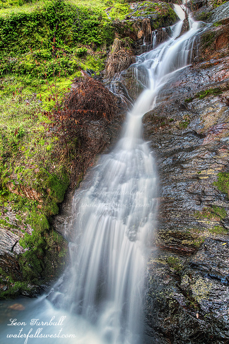
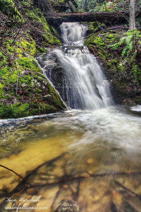
And there are other undiscovered waterfalls at Whiskeytown as well, I am sure of that. After my first hike failed, I decided to explore this other Creek, which is actually quite a major Creek, though it is unnamed. There was, unfortunately, quite a lot of poison oak, but I made my way down to the creek, and worked my way up stream. In short order I could see a waterfall. I had to go through a lot of oak, crawl over a huge log, and carefully make my way up along the steep side of the creek bed. I finally arrived at the falls. It is a pretty one, 36 feet high. I guess you could say that it is unfortunate that log is cutting off the top of it, but on the other hand, I think the log gives quite a bit of character to the waterfall (kinda like Lion Slide Falls, for example). So it’s not too bad at all. I would have liked to explore more, but I was poison oaked out, not to mention quite tired.
As I hiked back up the trail, I came across a deer coming down towards me. It saw me clearly, but instead of running away like deer usually do, it kept coming for me, straight for me. It totally freaked me out. What did it think it was doing? I am a human! We kill deer and eat them for breakfast! Well, not me personally. I even backed off a bit, to give it more space to pass me, otherwise it would’ve passed within a couple feet of me. It came to within less than 10 feet of me, then decided to go off the path and up into the woods away from me. Whoa that was crazy. First killer cows, and now killer deer? What is the world coming to?