Emerald Again

I took a lot longer photographing the lunar eclipse than I anticipated or wanted. My plan was to leave by 6:30AM and drive on up I-80 right afterwards to Yuba Gap, and back to the Emerald Pools. I ended up leaving 30 minutes later than that, and that was after stopping at Starbucks to refuel. I thought about just going back to bed, but according to my calculations, the sun would not be hitting the Emerald Pools until 9AM or 9:30AM, and so I figured that would still give me plenty of time to get there. And it did.

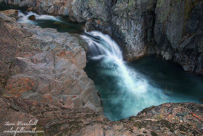
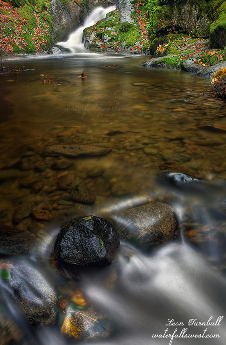
If you remember my last photo of Emerald Pools, you will recall I could not in any way get down to the bottom to photograph the waterfall from below. My intent this time was to approach the falls from the other side of the river. It looked quite steep from the other side, but do-able. As it turned out, it was actually fairly easy to get down, though it did take longer than I expected. I ended up following what appeared to be a mountain biking trail in recluse, abandoned to the elements, or at least to only the occasional summer hiker. It followed the river downstream for awhile, then turned away from it, and seemed to end along Bowman Rd. At that point I went cross country, making my way back to the river, and then down the steep hillside to the river. I ended up exactly where I wanted to, at the bottom of the Emerald Pools, with a great view of the two tiered waterfall that I could not get from the other side. I got two super nice photos of this place, and I could not decide which one I liked better. I’ll probably share the other one later, but this one is more of a closeup of the falls. It perhaps looks a bit bigger than it really is, but it is precisely 20 ft. high, the upper tier 15 ft, and the lower 5 ft.

After shooting Emerald Pools, I went down river a ways more and found a really interesting 30 ft. high waterfall, but with too much sun, and no way to get in position to photograph the waterfall in any respect, due to the cliffy terrain. I know there are even more waterfalls on the river below this one, but the gorge gets crazy steep in very short order. Only kayakers can get down there. Or maybe not.
2 Comments

The Eclipse

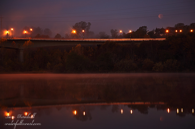
Well here is my take on this morning’s lunar eclipse. It is not great.

I thought I would try to do a couple things this morning, shoot two birds with one stone, so to speak. The first of these was to get up super early to shoot the eclipse. The second was to go waterfallin’ up in the Sierra. I got up at a little before 5AM, and made my way down to the American River and Folsom Bridge, a cup of coffee in my hand to help warm me up in the cold. I knew the moon would be in this position in the morning from checking The Photographer’s Ephemeris, and the day before I had taken my daughter down here to scout out a possible shooting location. I did not see those power lines! It was too dark in the morning to see them, and when I had scouted with my daughter I did not see them either (as we did not get down here until almost dark). So I did not see that they were in the shot until afterwards. I was bummed about it, as the moon is kinda right in the middle of them, but I figured it would be too hard to clone them out, so I just left them in there. Other than that though, I really like the shot. It turned out much better than I expected.

Anyway, I figure I’m much better at photographing waterfalls than moons, so after the eclipse I headed up I-80, and I got to a pretty cool spot as well. That pic will be coming up next.

No Comments

Middle Brandy?

I love studying topo maps to try to find new waterfalls. I suspected there might be other waterfalls on Brandy Creek and my goal on Thanksgiving Day was to find them.

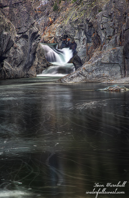
I cut down off the main trail and descended the steep terrain to creek level to the spot on my map where I figured there should be a waterfall. Nothing. But not giving up yet, I then traversed downstream. I found something. Two somethings. Unfortunately though, they were small somethings. The upper and prettier something shown here is about 11 ft high. I could not get any closer to the falls than this as that pool is quite deep. The lower falls is about 15 ft high though from certain angles above it looks much higher. It was very cliffy and too difficult to get down to it. If it was bigger I would have attempted it but instead I just took photos of the upper and more photogenic falls. I was bummed these falls were not bigger as I do not think they warrant inclusion on my website. Oh well. I ran out of time to explore as I needed to get to Redding.

On the way back down I passed another group of hikers and then saw more as I drove back down the road. I was surprised. I did not think I’d see anyone out and about on this day. I guess they had the same idea as I did to get a good hike in before eating their big meals.

No Comments

Emerald

This last Saturday I went to check out Emerald Pools on the South Fork Yuba River. Finally. It has been on my list for a long time, but rather low on the list, and I just had not found the time to get out there. But here in December, I learned that the river was flowing right now, as they are letting water out of Spaulding Lake for some reason or other. How did I know this? By checking dreamflows.com, an excellent resource, used mostly by kayakers, but quite useful for waterfallers as well.

I had planned to go in the morning, but with getting zero sleep the night before, I decided in the middle of the night to skip that plan, and go in the afternoon instead. I arrived about 2pm, and with sunset being so early, that did not leave a lot of time for exploring. Fortunately, I found the river already in shade. Perfect for photography purposes. There is a bit of a trail following the river downstream, and so I followed it, weaving this way and that way, over and around rocks and cliffy sections, until I made my way down to the location of the Emerald Pools. It would have been much quicker to cut straight across instead of following the river path, and that is how I went back. Easy smeasy.

At the Emerald Pools, I came to somewhat of a deadend. There was no way down to the bottom. I was a bit surprised, as it is a popular place for swimming in the summer. How do people get down there? The only way I figured possible would be to go quite a ways downstream, past the cliffy section, work your way down to the river and then back upstream to the pools. It would also be necessary to cross the river in order to see the falls (or swim up to them), and that might be easy in the summer, but it was flowing a bit too swiftly for me to cross today.

Instead of doing that, I tried to make my way down the cliff to get in a position to see the waterfall. It was very tricky. The slope was on the steep side, and very crumbly. I thought I might just slip and slide all the way down the cliff and into the river. There was also one big step down that I needed to make, it was definitely on the edge of my comfort zone, but I carefully carefully made it down to a viewpoint where I could see the upper falls. There are two waterfalls here, and the total height is about 25 ft. The first one is 15 ft. high (measured), though it may not look like it from this angle. The second one immediately below this is about 10 ft high, but I could in no way, shape, or manner, get to any place to view it (and I did try). But as I said, you’d have to go way downstream, cross the river, and back up on the other side, where I think you could view the falls from there, but you’d only be able to do this in the summer when the river flow is much lower. It was getting late though, and I had to get back to my car. By the way, if you see any yellow sunglasses down here, they are yours truly.

No Comments

Thanksgiving Brandy

Thanksgiving Day. Time: 3:30AM. Event: Alarm Rings. Action: Wake Up. Make coffee. Drive north to meet family for Thanksgiving Day. First stop off at Brandy Creek for a quick morning hike and exploration.

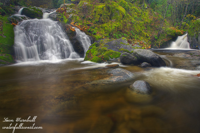
This was how my day shaped up for me. Getting a good solid hike in before eating a big meal is always a good thing. My first stop along Brandy Creek was Lower Brandy Creek Falls (Rich Gulch Falls), which I have not stopped at in a very long time. Though I have called it Lower Brandy Creek Falls in the past, the waterfall is not actually on Brandy Creek but on Rich Gulch. The small 10 ft falls on the right is Brandy Creek. The larger one on the left (which I measured as being 18 ft high) is Rich Gulch.

It is a steep descent from the trail down to creek level but is not really too difficult. I quickly decided the best viewpoint was from the other side of the creek and since the creek was flowing higher due to recent rain, that meant getting wet. I donned my water shoes and crossed the creek. It was cold. Fortunately, there was a nice large rock on the other side to stand on so I did not have to shoot from in the creek.

After spending quite a lot of time here shooting this lower falls I continued on up the trail as I still had some time before Thanksgiving lunch with family in Redding. Not to the upper falls though. I was in an exploring mood for searching out new waterfalls on Brandy Creek. Did I find any? Stay tuned.

2 Comments