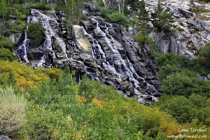
Kings Creek Falls

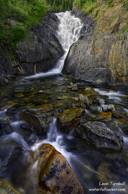
As soon as the sun starting hitting Kings Creek Cascades, I packed up my gear and booted my behind down to Kings Creek Falls. I knew I had about 30 minutes and not much more before the sun started to hit this lower falls as well.

I took this first shot from the overlook. It is the typical, standard, un-unique, most highly photographed spot for this waterfall. But as it turned out, this was the best shot of the day that I took of this falls. I did go down to the base, and I did get on my water shoes and stand in the middle of the extremely freezing cold stream to take a shot of the falls, but I wasn’t really too pleased with how that shot turned out. There was quite a bit of mist down there (even though the falls were not roaring) and that always makes it tough to shoot. Anyway, this shot is pretty nice I think.

2 Comments

Kings Creek Sunrise

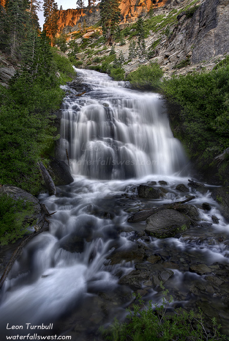
I arrived at the trailhead for Kings Creek in the dark. I knew that the sun would be hitting Kings Creek Cascades right at sunrise, and then hitting Kings Creek Falls very shortly after. If you want to photograph these falls, you must be down there at or before sunrise. Because of this, I had not previously gotten any really good shots of the Cascades, and I wanted to be sure that this time was different.

There were mosquitoes out and about along the Kings Creek trail. Bummer. I sprayed myself with bug juice to keep them away. It worked. There was also still some snow along the trail in various places. Kings Creek had a good flow to it, but I was actually expecting it to be rushing a lot harder. I was thinking that it would not be crossable (which I needed to do – down at the falls), but in fact it would be very easy to cross. I approached the junction which leads down to the Cascades and found that it was closed! I have no idea why, it is not like this trail was too dangerous to follow or anything like that. This closure was really bad of course because this is where I wanted to go. And of course, I obeyed the closure and went around on the horse trail down to the falls. Ahem.

I must say that I am very pleased with this shot. Initially, I had thought that I arrived about ten minutes too late to capture the best color in the sky. That is probably true, however, when I got home, I was very happy with how this shot turned out. In fact, I think it is my personal favorite of this year so far. It was a very beautiful morning in Lassen Volcanic NP.

2 Comments

To Lassen We Will Go

Everyone knows that there are three and only three waterfalls in Lassen Volcanic National Park: Mill Creek Falls, Kings Creek Falls, and Kings Creek Cascades. It is a very beautiful park and has plenty to see, but there are only three waterfalls there. Yeah right. Everyone can keep thinking that.

If you are reading this, you should know by now that I cannot accept such a paltry number for such a beautiful park.If there is steep terrain and plenty of creeks, then there must be waterfalls. And Leon Turnbull will find them.

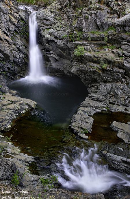
I did have a bit of help with this one (thanks Michael J.). But I am definitely a bit shocked that Grassy Swale Falls has never been documented or posted before.  Okay, it is not as big or spectacular as Mill Creek or Kings Creek, but still it is quite a lovely cascade, 43 ft. high. And it was high on my list to visit this summer when I was up north.

It is quite an easy hike to get to this waterfall. I was thinking it would be much more difficult than it was. The maintained trail begins at Summit Lake, leads down to a couple of crossings of Kings Creek (I didn’t even need to get my feet wet there), and then voila, there it is. Getting down to the bottom of it was a bit tricky and steep, but nothing too bad. I arrived at the falls early, and there was still a lot of sun shining on the falls. So I found a spot to sit and I waited for the light to get better. It was actually very pleasant, and surprisingly, no mosquitoes (there “were” mosquitoes at Kings Creek so I was happy about that). I was happy sitting here, enjoying the waterfall, then after taking my shots, hiked back up to Summit Lake, arriving well before sunset. A good day at Lassen and a new waterfall found. And in case you are wondering, there are more waterfalls to be found in Lassen than just this one as well. But that is another post.

No Comments

More Exploring in New York Canyon

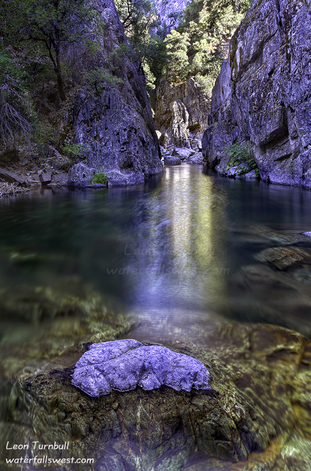
I’ve been up north this past week and I have quite a few new photos to process. I will get to them soon. In the meantime, this shot is from last month while exploring in New York Canyon, my favorite of favorite places.

When my friend Rob and I returned from our adventure to New York Canyon Falls, on a different route via “Macklin Ridge” (see prior post on New York Canyon Falls), we discovered a couple other waterfalls on New York Creek above the “big waterfall”. The one we saw from the ridge looked like a really nice one so I decided to return here 3 days later on my own to try to get down to it.

Within only 3 days, almost all of the snow along Sailor Flat Rd. had vanished like it was never there to begin with. The creeks were still flowing, but it wouldn’t be long before they were as good as vanished as well. I hiked down Macklin Ridge until I could see the waterfall, then made the steep descent down towards the creek. When I say steep, I mean steep. It was not cliffy but it was definitely very tricky. I had to be very careful not to slip and fall. As I approached the falls, things got even trickier. By that I mean cliffy. I didn’t think I was going to be able to get a very good look at the falls, but I persevered and came down to a viewpoint that was fairly close to the falls. I’m sure in the spring this would be roaring down the canyon, but now it is just a dainty looking waterfall, but quite a nice one at 96 ft. high. I am not sure if I could have gotten any closer to it. The next ridge over to the falls was a steep one. It may have been possible but I was satisfied with my current viewpoint, so I didn’t try it this time. After taking my shots, I started the climb back up to the top of Macklin Ridge. I went straight up instead of looping around onto the slope that was less steep. I think that was probably a mistake, but I huffed and I puffed, and I crawled to the top.

I called this one Middle New York Canyon Falls. There is an Upper New York Canyon Falls as well. I tried to get over to it but I could not get a good view of it and the cliffs around that one are even steeper and cliffier. I’ll need to figure out how to get to it though, cuz I think it is even nicer than the middle falls.

2 Comments

Nemesis

Finally. This one has been my nemesis for a couple years now. And after a couple tries, I was finally able to get to it. This is Eagle Lake Falls at Lake Tahoe. It is 174 ft. high, and it is extreme spectacular-ness.

Now … I suspect that most people have never heard of this waterfall before at Lake Tahoe. Eagle Lake Falls? What the heck? Everyone (and I mean everyone) knows about Eagle Falls at Emerald Bay. It is one of the most photographed waterfalls in California. Most people would also know about Upper Eagle Falls as well. But there is another waterfall on the same stream, and this one is actually bigger than Lower Eagle Falls (which is 140 ft. high).  I want to even say that this waterfall is better than Lower Eagle Falls, but I will refrain from saying that for now.

I would say that the vast majority of visitors to Eagle Falls, only visit the Lower Eagle Falls, and perhaps the Upper Eagle Falls. Only a fraction venture above the bridge at Upper Eagle Falls, and visit Eagle Lake. And only a fraction of that fraction venture further than Eagle Lake. But there is a whole world of exploring to be done in the Desolation Wilderness. The Desolation Wilderness is actually a fairly popular backpacking area, so a fraction of a fraction is still quite a lot of people. Nonetheless, it is a beautiful place that not too many people will see. And if you hike above Eagle Lake, and if you are looking for it, you can see this waterfall above Eagle Lake from the trail. But it is a long way off, and an extremely steep descent, and there are no trails venturing down to it. That is where I come in. Waterfall Hunter.

I saw this waterfall first a couple years ago when I was hiking up in the Desolation Wilderness. From a distance it did not look like a huge waterfall. In fact, after studying Google Earth and my topo maps, I kinda figured it was maybe 50 ft. or so high. Nonetheless, I still wanted to add it to my collection of course. I tried accessing it first from Eagle Lake, by hiking over the rocks and talus slides along Eagle Lake to the end, then going upstream from there. I made it to the end of Eagle Lake, but then ran into a dead end, with steep cliffs and very thick brush. There is a lot of thick brush at the end of Eagle Lake. I did not make it to the falls.

Hmmm … how could I possibly make it to this remote and seemingly inaccessible waterfall? I studied my maps and GE some more, and came up with a new route. My new route was to access it from above, venturing off the main trail above Eagle Lake, and coming down to the falls from above. GE showed a lot of probable brush in the area, but it looked like the cliff beside the falls was not too steep from GE, and I could access it from there. Yeah, right.

So off I went up to Lake Tahoe on a Tuesday afternoon in late July. When I arrived at Eagle Falls, there was a lot of people around. I was lucky to get a parking spot at the trailhead. I could see that Eagle Falls was still running quite well. And I could also see there was still snow on some of the mountains. Shocker. Usually, by this time of year, Eagle Falls is reduced to a trickle. Thank you, 140 percent of normal snow pack. This was definitely a good sign.

It was quite a warm day (80 degrees) for a hike up into the Desolation Wilderness, but up up up I went. When I got up above Eagle Lake, I left the crowds behind me, and I came into view of the waterfall for the first time. I could see that the cliff beside the waterfall was definitely far too steep to make a descent. It seemed so much tamer on GE. There was no way I would be descending down that. Nonetheless, I continued on, hoping to find another route down once I got there. I came to another dilemma once I reached the spot where I was to break off trail and head down to the falls. It was steep! It did not look too promising, and I was considering giving up my quest for the day. But … I had come all this way up here, so I decided to try it. As I descended, I actually found a path. People had obviously been down here before. It was a good path in spots, and in others, it was hard to follow. But I was following it. It was not my original planned route, but it was leading me down to the falls. As I descended, I could see the waterfall, and I could easily see that it was definitely a lot bigger than I had anticipated. It was certainly no 50 footer. This was very cool. I was feeling very good.

Then … as I crossed a brushy ravine and headed up onto a ridge, I could see the waterfall in plain view ahead of me. It looked like I was going to make it. Then all of a sudden … I came to a dead end. A big cliff dropoff right in front of me. Crikey! I had almost made it all the way to the falls, and now I was stopped. Well, I could still take my pictures from this spot. The view of the falls was excellent from here. But I was definitely bummed that I did not make it all the way to the waterfall. After taking my pictures, I did find a possible descent down the cliff. But I could not tell if I would be able to continue all the way or not. Maybe it was possible. But it was now getting very late. I had run out of time. If I went down now, I would be hiking back in the dark. So I decided to not try it this time, and come back another day.

I started heading back up to the main trail. It was a very steep and slow ascent. The high elevation was definitely getting to me, and I was even feeling a bit dizzy as I ascended. Finally, I got back to the main trail. Now it was all downhill back to the car. I was quite bagged though from this very strenuous hike, and I drank all the water in my camelbak before I made it back down, and I arrived just after sunset. Some light clouds had rolled in surprisingly over the Bay, and I was actually hoping for a nice sunset at Eagle Falls. But I arrived there a bit too late (but the clouds did not really color up too nicely anyway, so I didn’t miss very much). I was totally bagged from the hike. I stopped at McDonald’s to refuel myself with a couple chicken sandwiches and ice cream before making the long drive home.

2 Comments