Lost

Well, we are back from our week long family vacation to Oregon. It is a long story which will be relayed on following blog posts, but the short story is we got rained out in Oregon. More like blown right out of the state. I think we picked the absolute worst possible week of the year to go camping in Oregon. Nonetheless, I did manage to visit 15 waterfalls over the course of the week, and we did have a pretty fun time. Except for one rather stormy night.

This photo is not Oregon. It is California. Good old California. Nice sunny California. Which has not really been too sunny very much so far this year. And that is the way I like it. But it seems the sun and heat are here now finally. Though on this particular day, it was rather overcast. And that makes for good waterfall photography.

On our way up to Oregon, we made a pit stop in Red Bluff, where my wife’s parents live. I took the dog for a morning hike one day up towards Lassen in search of a new waterfall. I found one.

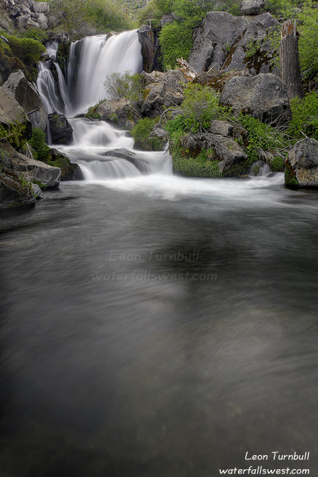
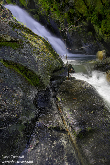
This is Lost Creek Falls, which is on a creek that is truly lost, out in the middle of almost nowhere, in Lassen National Forest. It is a rather pleasant hike out in the middle of almost nowhere. It seems there shouldn’t be a waterfall here. The landscape is so rather flat. But perseverance pays off. And eventually, you can make your way up a little canyon where Lost Creek can actually be found. And lo and behold a waterfall. A rather gorgeous little thing, 27 ft. high.

Just downstream from this falls is a powerhouse out in the middle of almost nowhere, and a small dam at the base of the falls. Although the powerhouse is private property, the falls and trail to the falls is on public land. I like that. I was standing beside the dam to take this photo. That explains the rather large pool below the falls and why I couldn’t really get any closer to the falls. Also worth mentioning is the rather grand views that can be had from this waterfall, or very near the waterfall. Views of majestic Mt. Shasta and Mt. Lassen both. It is quite a sight when both these mountains can be seen from one spot. I was actually considering taking my sunrise shoot of Mt. Lassen from Manzanita Lake. The clouds on the drive up Hwy 44 towards Lassen were looking rather potentially fabulous for sunrise. I couldn’t decide. Shoot the waterfall or shoot the mountain for sunrise. I decided on the mountain. However, when I arrived at Manzanita Lake, the clouds over Lassen were gone! The sky was completely clear. Where did the clouds go? Well, they were still there, but just in totally the wrong spot for a sunrise shot of Lassen. I decided to high tail it around and return to my original plan, that is get to the waterfall for sunrise. I thought I was going to be rather late, but the overcastness kicked into gear, and I didn’t have to worry about the sun ruining my waterfall photography plans. Such strange weather we are having this spring.

No Comments
Surprise

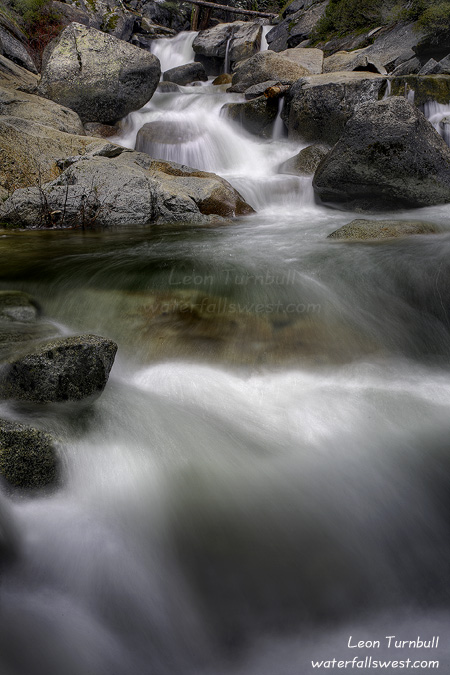
This was definitely a nice little surprise I found right alongside the road. I had no idea there was a waterfall here on Tells Creek as I drove up Ice House Rd., though it probably won’t be much to look at after all the snow is melted. But right now, it is a fabulous cascade, 28 ft. high, and very easy to get down to.

No Comments

If at first you don’t succeed …

… then try again. If you fail a second time, then try a third. Let’s just hope you don’t strike out.

I was working on two strikes before I finally reached this fabulous cascade on Deer Creek off Ice House Rd. It sure wasn’t easy getting to this new found waterfall, but I did it. And that definitely made me a happy camper.

But I almost didn’t make it. Indeed, I wasn’t really in much of a hiking mood today, certainly not for a killer 5 hour hike. I actually got a decent night’s sleep (for once). I woke up at 3AM ready to go and made the long drive up Ice House Rd.

I was trying to first shoot sunrise at Loon Lake. The forecast was calling for increasing cloudiness for the morning. I was really hoping for some fantastic sunrise clouds over the lake. Not a cloud in the sky. What the hey? It was supposed to be overcast by 8AM, and rain later in the day. I was bummed. That is probably what put me in a sour non-hiking type of mood.

Nonetheless, after a quick stop at the lake (I didn’t even wait around for the sunrise), I started off on my hike anyway. I was trying to find a new waterfall on Deer Creek. Now I consider myself a pretty darn good route finder. With my excellent GPS, I can find and follow anything (if it exists, that is). According to the topo maps, there is an old trail that follows Deer Creek down to the Rubicon Trail. Well, I could not find it. There may have been a trail at one time long ago, but it is no more. I was wandering through the forest looking high and low for any hint of a trail. Nothing. I had my GPS but I was still worried I might get lost in the forest. My GPS is excellent under tree cover, but if I lost a signal, I could be in trouble. Eventually, I turned back, realizing that there was no trail. Strike one.

But there was an old logging road, so I decided to follow it down and see where it went. It led down to the creek, then seemed to continue up the creek (instead of going down to where the waterfall would be). No good following the logging road. Strike two.

But on the way back, I did find a trail. This was actually a secondary trail on the topo map going down to Deer Creek. By this time, I was ready to quit, especially for not being in much of a hiking mood. Nonetheless, I followed it down. It was overgrown, but it was clear enough to follow. The trail did not follow the correct contour as indicated on the USGS topo maps. It led down to a logging road, then stopped. Possibly the same logging road as I was following earlier. This time the logging road did continue down Deer Creek, so I followed it down. I soon realized it was going to continue on down right to the waterfall. Sweet. Now the only question was whether I could actually get down to the falls or not.

As I approached the vicinity of the waterfall, I had to get off the road, and do some scrambling down to the falls. It was steep. It was cliffy as well. I was still not in a hiking mood. But I was deep into the hike and if I came all this way down, there was no way I was not going to do everything possible to get to the waterfall. I did find a route down to the bottom of the waterfall. It was really a fabulous cascade, which I measured to be 99 ft. high. The only problem was that there was no good view of the falls from the bottom. There was a ton of fallen logs, trees, and brush in the way. Not to mention, by this time the sun was shining right on the falls. What happened to those overcast skies by 8AM? I could not get any closer due to the cliffs. I took a quick snap, then started back up the hill. However, I decided to try again, going back down to the falls, around the cliff section, and closer to the top of the waterfall. From there, I was able to make my way down to the creek again, this time right close to the base of the falls. It was still difficult to take a photo from there, but I did manage to get this somewhat decent shot of the bottom 25 ft. section of the waterfall. Time to head back up the long difficult trail back to the car. But now I was in a great mood.

4 Comments

Anniversary Waterfallin’

Today was my wife Tara and my 11th wedding anniversary. Of course I had a great idea on how we should celebrate: go waterfallin’! Actually, Tara was quite game for this idea, believe it or not. Tara’s brother and his wife came over to look after our kids for the day, and so off we went into the mountains to do some hiking and waterfall hunting.

I was hoping to find up to three possible new waterfalls as well as go to Bassi Falls. It didn’t quite work out this way, but we did have a lot of fun.

The thing about me is … I like to study topo maps and find potential places where there might be waterfalls. Sometimes I go out and find a nice little surprise. Other times, I find nothing. But it is all fun to me anyway. So anyway, I found three possible locations for new falls in the vicinity of Bassi Falls along Ice House Rd. that I wanted to try out.

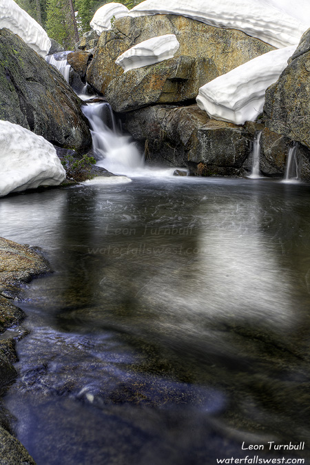
It was sunny in Folsom when we started out, but as we drove up Ice House Rd. conditions changed. It had snowed the night before up there, very surprisingly, and there was quite a lot of it still along the road. Hmmm. We started driving up a dirt road that was covered in new snow. It was fun, but eventually we came to a big snow drift and were forced to get out and walk the rest of the way. Unfortunately, we didn’t make it to where I was hoping. We came to a creek crossing and the creek was flowing very deep. We probably could have crossed it had we been prepared, but it was very cold and very deep; actually, it probably would have been a bit crazy to cross it. I was a bit bummed, because I really was hoping to get to this one particular spot. Well, strike one. The next stop was to go back upstream on this same creek (without crossing it). This we did, and in fact, we did find a waterfall. Here it is. Actually, it is not much of a waterfall, only about 15 ft. high. But with the creek flowing so well, it is an exciting little thing. This is Jones Fork Silver Creek Falls. As I was taking the photos, the clouds rolled in and it started snowing again. It was a bit of a blizzard with snow blowing around and quite cold as well. Did anyone say it was May yet?

Anyway, off we went to destination number three. That ended up being another strike. We were able to get to the creek where I thought a waterfall might be, but alas, no waterfall. So the results from the day were 1 out of 3 (maybe more like 1/2 out of 3, since the one was only 15 ft. high). Still though, it was a very fun day. We didn’t end up going to Bassi Falls since we were out of time; instead, we went back to Folsom and had a nice dinner out before heading back home.

No Comments

Snow Shoeing in May

Snow shoeing in the middle of May? Are you kidding me? No I am not! Such was my adventure this week, and it was a very fun one!

My goal: To find new waterfalls up on Ice House Rd. in the area of Loon Lake. I only ended up finding two new (small) waterfalls, though I was hoping for a lot more.

I have had loads of trouble getting to sleep at night lately. I have no idea why. But especially when I am planning to wake up very early the next morning to hike, I just haven’t been able to sleep well the night before. Usually when this happens, I turn off the alarm and skip my hike. This time, however, I was determined to get up hiking anyway. I had to. The forecast was for overcast skies on this morning, which is a rarity for California in May. I had a cool plan to attempt to get to multiple waterfalls, and I needed overcast skies in order to have decent light for photography at all of them. It was a great plan, though it did not work out that way. So I got up at 3:30AM with less than an hour of sleep and headed off with my very full coffee cup up Ice House Rd. in the wee hours of the morning.

In the winter, SMUD plows Ice House Rd. all the way to Loon Lake. That is sweet, because otherwise this road would still be snowed in. At about 6000 ft. elevation, there was still a lot of snow on the ground. I was surprised to see so much snow. Loon Lake in fact, was still partially frozen. It looked very beautiful like this, and would make for a great sunrise photo (if the skies were not so overcast, that is). The road to the far end of the lake is not plowed, so once I arrived at Loon Lake I had to get on the snow shoes and walk 2.5 miles to the end. It was a beautiful morning for snow shoeing. I saw some semi fresh bear tracks in the snow, bobcat tracks (I think), and plenty of squirrel tracks. I also saw tire tracks. Apparently, some people had driven this road in their 4×4 to the end. I thought this was a bit crazy, it would be so easy to get stuck in the snow with your vehicle. There was no way in HE double hockey sticks that I would be driving my SUV along this road right now.

At the end of the lake is an outlet stream called Gerle Creek. It was flowing somewhat okay but it is still too early in the year for the full snowmelt to swell this creek to maximum. There are a couple waterfalls on this creek. The first is just a small one, just a little ways down from the lake. It is so small, I missed it on the way down. I was hoping to initially get to a bigger waterfall downstream, but I just could not make it. It was too difficult. Too much snow, brush, and swamp that had to be crossed (but the good news is that I think figured out an easier way to get to this other waterfall, so I will be returning very soon). I decided to turn around and on the way back found this small waterfall. I think it would be more impressive with more water flowing in the creek, but it was still kinda pretty.

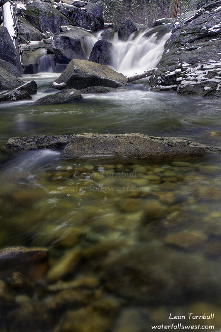
Upper Gerle Creek Falls is only 19 ft. high. It would have been nice to move over a bit to the right to get more of the upper portion of the falls in the picture. That would have meant I’d be getting very wet, which I was not prepared to do. Also, my tripod leg had broken! One of the screws had fallen off, nowhere to be found. It had only one screw left and was hanging on by a thread. I was afraid the whole thing would collapse in the middle of taking a picture, and send everything crashing down into the creek, camera included. Nonetheless, I managed to stable it securely enough to take this photo. By this time, the sun had come out as well, making the falls a bit more difficult to photograph. What happened to those overcast skies that were supposed to be here all morning? Oh well, I was done anyway and started the long snow shoe hike back to my vehicle.

No Comments