UPPER TENAYA CREEK
Upper Tenaya Creek Falls, 330 ft. high in total. There was no breeze at this lower section and the mosquitoes were out of this world. I did not spend much time there!
No Comments
Upper Tenaya Creek Falls, 330 ft. high in total. There was no breeze at this lower section and the mosquitoes were out of this world. I did not spend much time there!
No Comments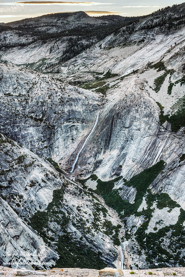
I got up at 4AM to go on my morning hike in Yosemite. The family did not want to go with me so I let them sleep in. I found out afterwards that Nekoda would have come with me. I am mad at myself about this because I thought none of them wanted to come.
It was very warm when I started the hike in the dark. However, there were no mosquitoes! I anticipated they would be out once the sun came up. Indeed, I really thought about sleeping in myself. I was so bummed about the hike the previous evening, I was not feeling good about doing another hike in the morning. I forced myself to get up out of bed. I am so glad I did.
I anticipated that about half of my hike would be off trail and through the forest. Again, this would not be good because there would be more mosquitoes in the forest and brush. However, I came to the turnoff point from the main trail, and I found a good, well defined trail leading off in my intended direction. It was not just a path, it was a good trail. I was shocked to see this. Was there a trail leading all the way to the waterfall viewpoint? I know others have probably been to see this waterfall, but I would be very surprised if there was a trail going to it. The trail continued in my direction almost all the way to the waterfall. This saved me a lot of time bushwhacking through the forest. It was awesome. I was almost all the way to the waterfall viewpoint when I finally realized where this trail was going. It was not going to the waterfall, but it was going up to the top of Mt Watkins. Now this finally made a lot more sense. In fact, I was almost to the top of Mt Watkins already. The question was, however, would I be able to see the waterfall from the top of Mt Watkins? I did not know the answer, but I knew for certain that I could see the falls from the ridge below, so I turned off the beautiful trail and down into the forest. It was a very short jaunt and then I was on the ridge overlooking Tenaya Canyon and Pywiack Cascade.
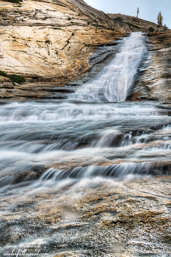
It was just past sunrise and the sun had not yet risen above the mountains. It was absolutely glorious. I took many photos until the sun came up. I could see Half Dome from this ridge, as well as the spectacular Tenaya Creek Canyon. The canyon and cliffs are incredible here with sheer dropoffs. Pywiack Cascade is about 740 ft. high, and there is a lower cascade as well that is over 150 ft. high. There is absolutely no possible way to get down to the bottom of this waterfall because of the cliffs. This is pretty much the only viewpoint of the waterfall as far as I know, but it is an amazing viewpoint.
Afterwards, I decided to climb up to the top of Mt Watkins since I only had another 200 ft. to the top. I was not really sure that I really wanted to climb up there, but decided I may as well do it since I had the time. It was a quick hike. You definitely cannot see Pywiack Cascade from the top, but there were more great views of Half Dome so I think it was worth it.
I hiked back down the mountain and to my car. There were zero mosquitoes on the entire hike. Even Jadon would have enjoyed the hike. Once I got back to the campsite, however, there were a lot of mosquitoes. Everyone was in the tent (2 out of 3 were still sleeping), so I made a fire to try to keep the buggers at bay. It worked somewhat but not well enough for the kids. They waited in the car while I packed up the tent.
I have said before that I have NEVER EVER seen a bear in any national park (in the USA or Canada). I have hiked probably a hundred times in Yosemite before (and backpacked) and never seen a bear. On our drive through the park to Tuolumne Meadows, my wife Tara saw a bear along the road. I did not see it. But this is the year of the bear, is it not? If the cycle is to be broken, it must be on this trip. Our campsite at Tuolumne Meadows was on the very end of the campground, next to the river and the forest. I was saying to Tara that if any bears were to come into the campground, they would have to come through our campsite first. Less than five minutes after saying that, Tara said, There’s a bear! Guess what? I saw it! The cycle is broken! It was up above our campsite meandering through the forest and not very close to us, but it was most definitely a bear, and it was most definitely in the national park. If Tara had not pointed it out, I am certain I would have missed it.
On the drive back home, we stopped in Groveland at Pizza Factory (the usual lunch stop from a Yosemite trip). It would have been a great trip if not for the mosquitoes, and I am bummed about it (mostly for the kids’ sakes), and also I’m sure the kids would have enjoyed it much more if they had come with me on the morning hike. Jadon’s rating was 0 out of 10 for the weekend (I don’t blame him). Nekoda’s rating was 6 out of 10. Oh well.
I said in one of my last posts that I was just going to have one final fling before summer for backpacking and hiking. However … I am a glutton for punishment. I wanted to get to Yosemite one more time to check out some new waterfalls that I have not been to yet. I thought it would be a good idea to bring the family for a camping trip and do these hikes with the crew. Big mistake. The plan did not work out very well. Even though Tioga Road had just opened a couple weeks ago, I was two weeks too late for this. The mosquitoes!
The mosquitoes in Tuolumne Meadows campground were horrendous when we arrived in the afternoon. We set up camp quickly and then left to wander around the meadows and visitor center area. It was beautiful along the Tuolumne River area with a nice breeze and no bugs there, so it was a very nice spot to relax. At about 4PM, it was time to go on our evening hike.
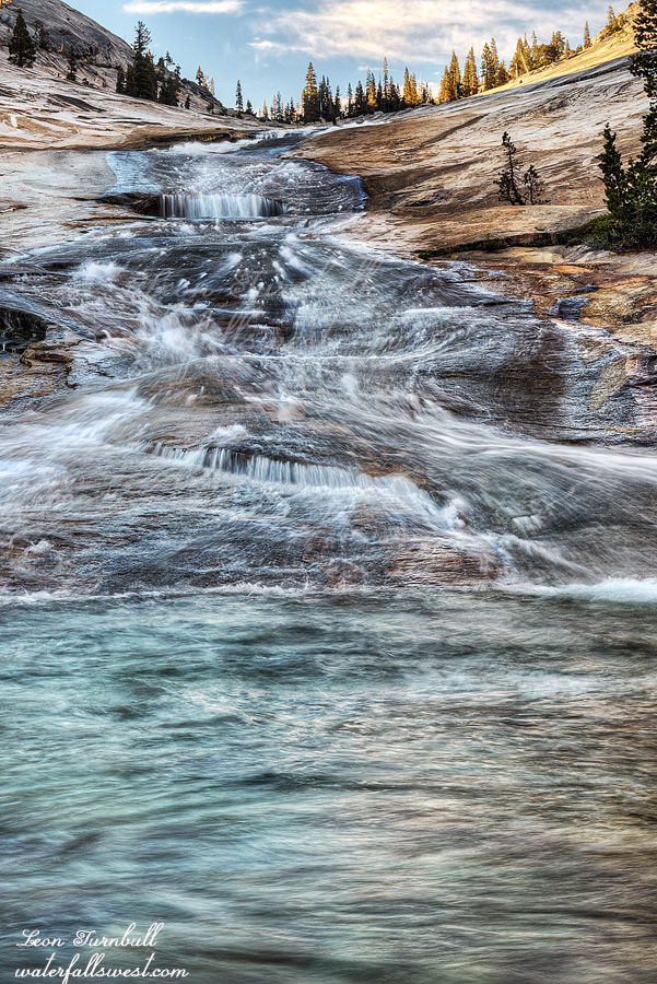
The plan was to hike down to Upper Tenaya Creek Falls and waterslide, and have our dinner at the waterfall.
It was not a very fun hike because of the mosquitoes. My poor son, Jadon. He inherits his sweet blood from myself and my mother, but he has it even worse than us. He had at least 10 visible bites on each of his arms and on each of his legs, and more than that elsewhere. The repellent did absolutely nothing for him whatsoever. I had zero visible bites, which I do not understand because they were definitely biting me A LOT. It was not very enjoyable. Down at the waterfall, we had some relief because there was a bit of a breeze and no mosquitoes there, so we ate our dinner in peace at the falls. However, when I went down to the bottom there was no breeze down there, and the mosquitoes were ridiculous, so I had to quickly take my photos of the lower cascades and run back up to my family (they did not come down with me to the bottom – and Jadon was thanking me profusely).
It was a very easy hike down to the waterfall, much easier than I expected, but it just would have been 100 times better with no mosquitoes. Well, I do think I would like to come back here someday. Tenaya Creek Falls was very beautiful but well below peak flow. The lower cascade especially would have been much better with a lot more water in the creek. It is a somewhat popular natural water slide in the summer, and I did see a girl sliding down into the pool at the bottom. She said the water was very cold.
We hiked back up the hill, arriving at the car after sunset. I gave Jadon the keys and he hiked back as fast as possible, but still got plenty of bites on the way. Poor kid. When we got back to the campground, we had some relief because of all the campfire smoke from other campers; there were no mosquitoes around. We relaxed a bit at the picnic table before heading into the tent for the night.
So all in all, even though it was a beautiful waterfall, it was not a very enjoyable hike. However, the next morning would be a million times better (for me, at least).
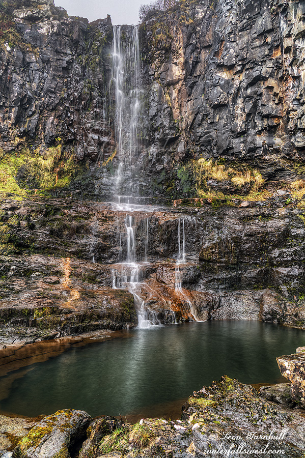
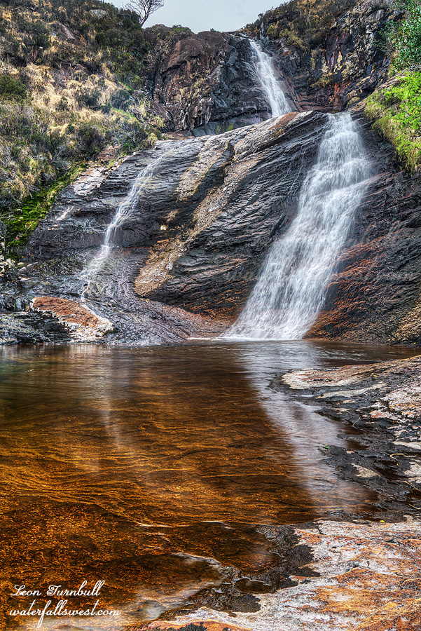
Carbost Burn Waterfall, Isle of Skye, Scotland. 80 ft. I thought this would be very difficult to get down to, but in fact was very easy. It is a very pretty falls, it would be stunning at higher flows.
4 Comments