DAY 2. LITTLE FLING

It was colder during the night than I anticipated. It’s weird how last week it was warmer than it should have been, and this week it was colder than it should have been. Maybe it’s just me? When I got up in the middle of the night to do my thing, the zipper on my tent was ended. Remember how I said it broke last week? After that, I rigged it up so it would work, and open and close if I was very careful. Well, I was being careful, but nonetheless, it tore wide open. This time there was no fixing it whatsoever. I knew this would happen eventually, I just hoped it would not be tonight. I zipped up the outer door, but the inner door was wide open. That meant things could still get in such as: bears, snakes, and bugs. I was hoping and praying that none of the above would actually get in. I’m not sure what would be worse. Bears would be worst, but I was not worried about that. Snakes would be next worst, and that was a very real and scary possibility. but the mosquitoes is what I was most concerned with. I hate hate hate the mosquitoes (I think I may have said that before). Fortunately, there were very few mosquitoes and I am thankful nothing got in my tent during the night (not even any ants!).

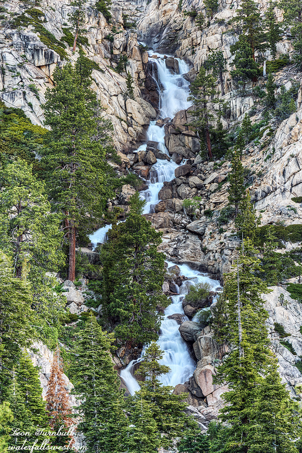
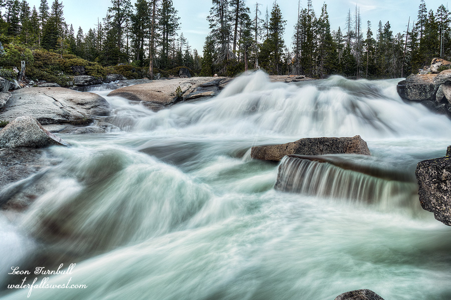
This small 10 ft. waterfall was right beside my campsite. Since it was there and since I was there, I decided to take some photos of it. It is kinda pretty.

After breakfast and packing up, I headed up the mountain. I had 1200 ft. to climb to the top of the ridge, then down to the trailhead. It was very slow going through the snow. I got back to the car at 12:30PM. That is 6 hours to hike 9 miles (it took 7 hours on the way in). I was beat up from all the snow hiking, but I had a great couple days in the Mokelumne Wilderness.

No Comments

DAY 1. FINAL FLING

July 6. This was to be my final backpacking trip for the summer. Just when (you might think) the snow is melting out and everyone else is finally getting out backpacking, I am quitting. Yeah, strange perhaps, but the bugs are also coming out to play now, and I hate hate hate the bugs, so I tend to not go out much in the summer. I actually went on one more backpacking trip this year (six) than I did last year. Considering that I also went to Scotland/Ireland for 10 days, I think that is pretty darn good! My trips this year tended to be shorter trips because I already took so many days off work for the overseas trip. I also had more failed backpacking trips this year (four) than last year. That is quite a lot and the reasons vary (ticks, snow, stream crossings, brush) but I usually made up for the failed trips with different ones.

I have heard a lot of people talking about this year and all the snow, afraid to go out in the snow and wondering where they can go backpacking with no snow. At the same time, I have heard other people going on crazy dangerous trips in the snow (with no problems – for them). I think it all depends on your comfort level and the more you go out and the more prepared you are, then the more you will be able to do. For example, one of my failed trips (last week) was going to be a big adventure into the Mokelumne Wilderness. Except that I came across one very dangerous snow field with a huge drop off into the abyss. One mistake and I would be dead. I chose to live and retreat. I am sure others could have traversed this snow field with no problem, but I only had micro spikes. With crampons and ice axe (and experience), I am sure I could have done it. Experience is a big thing. I read often about people dying because they do things beyond their capabilities and without proper preparedness. Also, it helps to be not afraid of heights. Yeah right.

This long-ish weekend (which was not a long weekend for myself), I returned to the Mokelumne Wilderness, to the same location. This would be a scaled down trip from what I had planned the week before (because I only had two days), and also I would be taking a different route (to bypass that dangerous snow field). The snow was still there. Lots of it. There was anywhere from 1 to 5 feet of snow. In some places, I just walked on the snow with my boots. In a few places, I needed to use the micro spikes but there was nothing dangerous on this route. It was just extremely tiring walking on the snow. On a trail that is mostly flat, it is not mostly flat when there is snow. You are constantly hiking up and down the snow mounds, which adds up to a lot of extra elevation, and let’s not mention the huge ankle breaking sun cups you are walking over. Without a GPS, following the trail is impossible, and I lost the trail a few times even with a GPS. All in all, it is just very tiring and very slow going.

You might think that since it was a long-ish weekend, I would see plenty of other backpackers/hikers. I saw zero people the entire weekend. I saw some horse tracks at the beginning but they were going off to another location. I saw one other set of recent tracks in the direction I was going. However, they stopped before the top of the pass. I guess the snow was too much for him/her. I was alone in the Mokelumne Wilderness.

It was 2PM when I came to the junction for the first waterfall I wanted to see. I had hiked for 5.5 hours and only gone 8.5 miles. I determined that it would be at least two hours (likely more) until I reached my planned destination (the second waterfall), but I was already beat up, and the next day going back would be brutal, especially if I took the detour to this first waterfall as planned. I decided to skip the second waterfall and go down to camp at the first one. I was ok with doing this because I really want to come back to this area again anyway, when I have a lot more time.

It was only one mile, but it still took over an hour to get down to the creek. It is a 600 ft. descent, and there is no trail. The first part was really nice, with very wide open granite. It reminded me of the Desolation Wilderness. The last part was steep and brushy. It reminded me of my recent trip to West Cherry Creek in the Emigrant Wilderness. It took a while to get through the brush and down the granite cliffs, but I made it down to the creek and found a campsite.

I thought the mosquitoes would be bad on this trip. I was expecting the worst. However, there was only one single mosquito that I swatted in the evening (there were a few more in the morning – but hardly worth mentioning, and I did not even break out the repellent).

So … stupid mistake number one: I FORGOT MY DINNER! Actually, this was the only mistake on this trip, but how on earth does one go backpacking and forget their dinner! I had to eat my next day’s lunch for dinner. That meant I had no lunch for the next day, but thankfully, I was planning to be back at the car by noon and I had snacks, so I figured I should be ok. (and I was).

The next problem: how would I get up to the waterfall? My camping spot was beside the creek about a half mile below the falls. There was a huge mound of heavy brush between myself and the waterfall. After a bit of exploring, I realized there was absolutely no possible way to get through or around that brush. There was only one option: cross the creek and try on the other side. It looked pretty brushy on the other side as well, but maybe it would possible. It would really suck to come all the way down to this waterfall and not even be able to see it!

Could I even cross the creek? The creek was flowing quite swift (still) and deep, and in some places it was definitely not crossable. Nonetheless, I found one place near my campsite that looked “not too bad”, and so after my lunch/dinner, I made my way to this spot to attempt the crossing, needing to remember that in a couple hours (when I came back), the creek would be quite a bit higher than this. The crossing was up to my thighs, but really not a problem at all. I did not anticipate it would be much worse in a couple hours (and it wasn’t).

On the other side, I donned my hiking boots and made my way upstream. It was not so brushy on this side. There were a couple spots but really not too difficult, and I quickly made my way to the bottom of the waterfall. It was gorgeous! Now I had to wait an hour for the sun to go down before I could take photos. It was worth the wait. Cole Creek Falls is a beauty, and I suspect few people (if any) have ever seen it before.

No Comments

DAY 2. PLEASANT SURPRISES

I got up in the middle of the night to go to the bathroom, and my tent zipper broke. I was fiddling with it in the dark for quite some time, and I could not get it fixed. I did not think I’d even be able to get back in the tent, but mostly I was worried mosquitoes would get in to the tent. There was now a big hole and no way to close it. Finally I opened the zipper, got in, and then closed it so there were no gaps. Now I was worried I would not be able to get out in the morning. I did, but the zipper is in bad shape now. I cannot afford a new tent. Maybe my wife can fix it (I hope).

It was supposed to be below 40 degrees at night. I brought extra warm clothes and sleeping gear, which added quite a few pounds to my pack. Argh. I did not need them! It was not cold at all, nowhere near 40 degrees. Thanks, Mr. Weatherman.

I got up at 5AM. I wanted to get an early start back home. I HATE driving through Placerville. It takes like 45 minutes to get through that stupid town, especially on Sundays with all the Tahoe traffic. Maybe if I got there before noon, it would not be so bad. I packed up my gear, had breakfast and headed up the hill. I had to climb 1200 ft. back to the PCT, from there it would be a long but easy hike back to the car. On the way down, it took 6 hours. On the way back, it took 4 hours. And that is with that big uphill climb! I was booting it back hard, but I still don’t know how it took so much less time. Nonetheless, even though it was before noon, Placerville still sucked!

This was a surprise waterfall, found on an unnamed creek flowing down into Pleasant Valley. It is at least 20 ft. high. I had to cross the creek to get down to my campsite, and it was the biggest by far of all the creeks I had to cross; it had strong flow for an unnamed creek. It was not dangerous or anything, but the water was up to my knees when I crossed. I am calling it Raymond Peak Falls. It is a pretty thing.


No Comments

DAY 1. PLEASANT DISCOVERIES

I took Friday off work with the intention of going on a big huge adventure in the Mokelumne Wilderness. It was going to be epic. Unfortunately, I came across very dangerous snow conditions. It is the end of June and there is still huge amounts of snow at high elevations. There was a big huge snow field with a deadly dropoff that I had to cross. There is no sense in dying. I had to retreat. I was bummed.

The next day, however, I returned to the Mokelumne Wilderness. I was much more optimistic about snow conditions for this second hike since the elevation would be a bit lower.

I would be hiking mostly on the Pacific Crest Trail. There was some snow on the trail, but nothing difficult, and the trail is very easy to follow. With so many people hiking this trail, it is clear to follow even if it is snow covered. I met a couple of PCT through hikers and chatted with them. They were happy and friendly. And why wouldn’t they be? They had just completed by far the most difficult section of the entire hike, making it through the Sierra Nevada (alive) after a huge winter snow pack. They said the creek crossings were challenging but not deadly. I thought that interesting because they must have come through at around peak flow. I would definitely think that some of the crossings would be impossible at that time. One of them told me about a very sketchy snow field that I potentially might have to cross in a few miles. Fortunately, I would be turning off the PCT before that point. Or would I?

There should have been a trail crossing the PCT and down to Pleasant Valley. It should be well defined. I saw it on Google Earth. Guess what? There was no trail. This was doubly odd because one of the through hikers I talked to said he saw the trail junction to Pleasant Valley. I do not know what he saw but there was most certainly no trail junction. I hiked right past the supposed trail junction. It was also extra difficult because in this area the PCT has been re-routed from the original trail. I found the old PCT and hiked along it for awhile, then went cross country,  came close to giving up, and then, miraculously, I found the trail to Pleasant Valley! Once on the trail, it is clear it has been traveled on somewhat occasionally because there are many rock cairns showing the way, but it is definitely very overgrown. You have to have an eagle eye to spot where the junction is with the PCT. It is not obvious whatsoever.

Once I came in view of the big waterfall, I needed to get off this overgrown trail, and cut straight down to the creek. It is steep, and you lose 1200 ft. of elevation, but it is not dangerous and there is a clear enough path going down.

I got all the way down to the creek and found a place to setup my tent. You cannot really see much of the waterfall from creek level, but there is a good view of it from 100 ft. higher up, so after dinner I climbed back up the mountain to take photographs. The total height of the falls is about 300 ft. high. It is a beautiful cascade. It does seem that others have been down in this canyon, but I have not heard of anyone else ever going down here. On this day and night, I was all alone at the bottom of this remote canyon in the Mokelumne Wilderness.

2 Comments

DAY 2. BACK TO THE DRAWING BOARD

I got up in the dark at 4:15AM, packed up quickly and headed up the mountain. I wanted to try to find a new waterfall. However, I totally underestimated the hike. It was an hour back up to the road. Then I had 3 miles to hike from there, however, it was off trail, with much elevation gain, through swamps, too much brush, and across icy hard (and dangerous) snow fields. It took far longer than anticipated. I was still at least an hour away from the falls when I realized the waterfall was already in the sun, and I had no chance to make it. I had run out of time, and I was past my turning around time. I needed to get back home. The animals I left alone all weekend would be starving by now. I will be back to this one some day when I have more time. Despite having to turn around, it was still an interesting hike with some great views of the Desolation Wilderness.

It was a very long hike back to the car. It was very hot as well (despite it being very cold in the morning). Thankfully, it was mostly downhill. I got back to my vehicle at noon, and home in time to have a big pizza for dinner. (and the animals were all fine of course).

This photo is the top section of Middle Bassi Falls from my campsite.

No Comments