DAY 1. SHUTDOWN!

Twas the night before the night before the night before Christmas, when all through the national park, not a creature was stirring, not even a park ranger. The waterfalls were flowing by the lake with care, in hopes that the madman soon would be there.

And he was!

Yes, I was off to Yosemite National Park on the morning of the government shutdown for a one night winter backpacking adventure. I had my permit, and I was allowed to enter into the park. It was only a partial shutdown, and I would be walking into the national park from Cherry Lake. I would be hiking to Lake Eleanor, but not just anywhere at Lake Eleanor, I would be hiking to the very far end of the lake. It was going to be extremely difficult, and I was expecting snow and winter conditions, so my pack was much heavier than normal.

When I picked up my permit in the morning, I find it interesting to see who else is backpacking at the same time. There was one other permit there for someone hiking in the next day for 2 nights. Here’s the thing: there was a big winter storm coming in! Did he not know this? Even more interesting than this, however, is that I saw him! He was just starting out at the trailhead when I was finishing. This was 4PM on Sunday, only 45 minutes before sunset. He only had 3 miles to hike, but he would be arriving at his destination after dark for certain. I asked him if he knew there was a winter storm coming? He replied “there is? Well, I do have a rain fly”. He seemed a bit clueless and unprepared for a winter storm. I mean, if you are going backpacking, how do you not know what the weather conditions are going to be? In 2018, I went on 9 backpacking trips, and had zero days of rain. In 2017, I only had one day with an afternoon thunderstorm, no other rain on any of my trips. Is this just good luck? Or good planning? I think it is both, actually. I watch the weather very closely, and pick the best days to go backpacking. I may change my planned dates if the weather is not looking good. I just think backpacking is a lot more fun if you do not have to deal with a lot of rain. For this trip, I knew there was only a 10 percent chance of rain for the weekend. In fact, I was expecting a bit of a shower for the hike back out on Sunday, but that did not even happen.

I was expecting cold weather, though, and snow on the ground. That did not happen either, but I wanted it. You see, I have an idea for a winter backpacking trip in the near future, but it is a very hardcore trip, and I have not backpacked in the winter before. I wanted a first trip to ease into something that would be incredibly difficult. According to CNRFC, there was snow at Lake Eleanor, and the temperature would be about freezing at night. Well there was no snow, and although it was cold at night, it was not even close to freezing. It was colder at Llewellyn Falls in September. Thus, I did not really get the winter experience I was hoping for. I had brought my new Thermarest Neo Air X Therm winter sleeping pad, and I brought both my sleeping bags, tucked inside each other at night. That was a bit overkill I think, and added an extra 2 pounds, but if it was as cold as expected, I think it would have been needed.

It was a great trip nonetheless, and also extremely difficult. There is an easy trail from Cherry Lake to Frog Creek at Lake Eleanor. It is a long hike, about 9 miles. I started hiking at 9AM, arriving at Frog Creek about 1PM. From there, no more trails. I crossed the creek, and went up to Frog Creek Falls, a very lovely 30 ft. cascade. After this, I wanted to hike to the end of Lake Eleanor where there is a very large waterfall (in fact, you can see it from the trail along Lake Eleanor). I planned to camp somewhere along the creek above the falls. Getting down to the waterfall, though, was going to be a challenge. The cliffs are huge at the end of the lake, and I did not think I would even get to see the waterfall at all from up close. It was very tiring just getting to the end of the lake. You need to climb way high up above the cliffs, then back down to the creek. It is only 1.5 miles, but it took almost 3 hours. I finally arrived at my camp, a nice spot along the creek, at 3:45PM, just one hour before sunset.

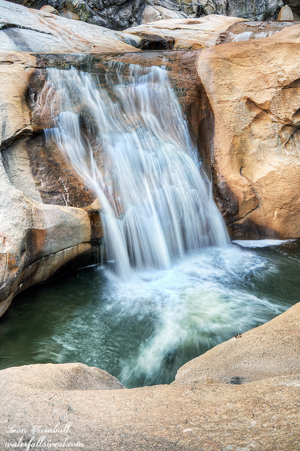
I dropped my pack and headed straight down to the waterfall. It is not easy getting down to it. At the brink of the falls, it is extremely steep and cliffy, but amazingly I found a view of the waterfall from the side. It is not a great one, but I was pretty happy to get even this view. I was not expecting anything. However, I could not get any further down. It was just too cliffy. It was now very late, and I just had time to take some photos and get back up to camp.

I was almost back to camp when I realized that I forgot my Inreach device back at the waterfall viewpoint. Ugh! So stupid, madman! I had to go all the way back down to retrieve it. By the time I got back to camp, it was after sunset. I set up my tent in the dark. I was extremely tired. I had been hiking basically non stop for 8 hours. It was now dark and cold, and I did not feel like cooking my dinner, so I had a snack and hopped into bed. It was early, but I was so tired. I tried to watch a movie on my phone, but I was too tired even for that. Time to sleep!

No Comments

LOST!

Who’s the madman? Yes, that is me. Who can find hidden waterfalls in the middle of nowhere that no one else has been to? Me, again. Well, I can’t quite take full credit on this one. It was waterfallswest friend Trailscout that found this on Google Earth, and told me about this falls on Lost Creek, though she has not been to it yet. How did I miss this one in my study? I scoured Google Earth and the USGS Topo Maps in this area, but somehow missed it, but it was there and it sure looked like a good one on GE. I had planned to go in the spring, but with the recent rain and before too much snow fell, it seemed like now would be as good a time as any.

It is a very long drive out here. Basically, you drive to the end of the world, then go a little further, and then get out of your car and hike another 4 miles. I probably could have driven some of those 4 miles, but there was a bit of snow and I felt like hiking anyway.

Thankfully, I fixed my GPS. I was going to order a cheap SD card just to see if that was the problem (before buying a new GPS), and when I looked at the picture of the SD card on-line, I saw a “lock” switch on it. I thought to myself, “no way”. I took out my old SD card and looked at it, and saw that it was in the lock position! This is why the GPS could not write any data to the card! I flicked the switch, and voila! The GPS and card are now working fine. It makes no sense, however, because I NEVER take the card out of the GPS, so how could the switch possibly have been changed?!?! Little gremlins ?

It is a good thing it is working now, otherwise I would have been completely lost. I started down the road and realized I needed to turn off down another drainage and road. Except there was no road! There was a very overgrown drainage that there is no way I could have navigated down. Looking at my map, I saw another possible road to take. It would add about 1.5 miles (1 way) to the hike, but I thought I had plenty of time so off I went. At first, this other road was very overgrown, with many fallen logs. I was about to turn back, then I noticed a light at the end of the tunnel, and the road opened up. From there on it was easy. Until, that is, I came to the end of the road, just above the waterfall.

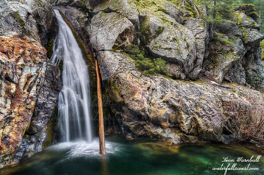
It is a steep descent from here, there is no trail, and a lot of brush (but no poison oak!). You are descending down to the creek beside a seasonal stream, which had a little bit of flow. Thankfully, not much flow because there was one little section where I had to go down right in the middle of the stream, because it was too steep on both sides of it. The only way to continue was to go right down the stream bed. It was very slippery and I had to be extremely careful. It was short, though, and once I got by the steep sections, I was able to get all the way down to the main creek. The waterfall was out of sight and around the corner. I could not even hear it yet. In order to see it, I had to cross the creek. I was able to rock hop across it, but it was difficult, and the rocks were very icy and slippery. I made it across, then I climbed up the icy rocks and logs on the other side, then across a sketchy talus slide, and there it was! An incredibly gorgeous 38 ft. high falls dropping into a magnificent emerald green pool. I was lost in another world. Such beauty. Such allure. Such grace. And who has ever seen this one or heard about this one before?

For more info on this waterfall, see my website:
https://www.waterfallswest.com/index.php#recent

No Comments

GIMME THE FACTS

It felt like a long time coming but winter has finally arrived in Northern California. It WAS a long time coming. However, as of Dec 1, we are almost back to average for precipitation this winter in Northern CA, and we ARE above average in Central and Southern Sierra. You heard that right: Not “below average”, but “above average”, thanks to a couple big late November storms, praise be to God who provides. In Northern CA, we are at 83% of average. In Central Sierra: 118% of average, and Southern Sierra: 147% of average. The snow pack is very similar: 82% North, 117% Central, and 128% for Southern Sierra as of Dec 1. This is fantastic news! I am not sure if the rain and snow will continue strong into December; there look to be a few storms in the next week or two but nothing really big.

So …. What’s the deal, man?

We always have dry periods throughout the winter. This is why I only tally the totals at the end of each month, not during the middle of the month. This year, our “first” dry period (and it won’t be the last one) began right at the beginning of the year, and in mid November we were at only 20% average for the year. But in two storms, we are now above average overall. Why bust your hearts looking at daily stats?

Sadly, the slow start was a major contributor to the Camp Fire, which was an awful and devastating catastrophe. But it did not cause the fire, nor did global warming cause it. The fire was caused by humans, (as are the vast majority of fires, by the way). Frankly, it makes me mad because the fire was (most likely) caused by PG&E negligence, and it should never have happened in the first place, and they did the exact same thing last year in Napa. Global warming should not be used as an excuse for accepting that devastating fires will occur. Do not say fires are the “new normal”. Let’s prevent fires from starting in the first place by being responsible.

I hear a lot that global warming is causing the drought in California. That is what everyone says, but is it true? What are the facts? Gimme the facts, man. If it is true, then shouldn’t we see an increasing pattern of dry winters in California? Yet:

2009 – avg
2010 – above avg
2011 – above avg
2012 – below avg
2013 – below avg
2014 – below avg
2015 – below avg
2016 – above avg (everyone seems to conveniently forget that 2016 was an above avg year, yet this was the year we started to climb out of the drought)
2017 – above avg
2018 – below avg
2019 – ???

I do not see any pattern of increasing dry winters here. Do you? I see an awful drought period, but even with that we have a 50/50 split of good/bad winters over the past 10 years. Going back further in years does not make any difference. Indeed, I checked back 50 years, and for every decade there was pretty much an exact 50/50 split of good vs. bad winters. 50 years! I also checked back 20 years for slow starts to the winter. I only found one other year (2014) that was as bad as this year to start (through mid November). Even so, we still ended up above average by the end of November 2018, and as I said that is why I only tally totals at the end of the month. So again, I do not see any pattern of increasing slow starts to the winter. Do you?

Are we even in a drought in California? What are the facts, man? Southern CA is still in a more serious drought, but Northern CA is not in a drought (or officially I guess you can say it is in a low drought status – which is normal after summer). I think it will all depend on if we have a good winter or a bad winter this year, as to whether we go back into a drought in California. Don’t say we are in a drought before winter has hardly even started. Let’s wait to see what happens by the end of the season. So pray for rain and snow! God is the only one that can seriously help and make a difference.

Anyhow … this photo is the upper waterfall of Bear River Reservoir Falls. It is 21 ft. high in total, including the upper 4 ft. tier. It is a pretty little one, but just a little one.

No Comments

PARADISE

Another rainy day in Paradise! Not Paradise the town. (close to it). A brand new spectacular waterfall discovery! Who could ask for anything more! It was a fantastic day for the madman.

I was not sure where to hike this weekend. It looked to be very rainy on Saturday around where I live. But the forecast said there would not be much (if any) rain in Oroville on Saturday morning, and it would be clearing. Yeah right.

So off to Oroville I went. It was raining there. Surprise surprise.

I was looking for a brand new waterfall, and this one was way out in the boondocks. A very long drive. Almost all the way out to Seven Falls. In fact, I was hoping to do a couple hikes this morning. After this first one, which should be easy, I would then hike down to Seven Falls, which I have not been to in a long time. I figured this first one would be an hour in, and then an hour back. So I should have plenty of time for Seven Falls, however it was actually two hours in and two back. It was 11:30 when I got back to the car. It was too late to go to Seven Falls. The sun was out by then. Not to mention I was very tired, and very wet.

Yes it was raining. And even snowing off and on. There was a bit of snow on the road at 4000 ft. elevation. Not too much, just a little. Just enough to make sure I drove slowly and carefully, as it was quite slushy on the roads. There was even a little snow down at the waterfall (as you can see).

My GPS stopped working. I’m not sure what happened, but it would not write or format the SD card. I tried another card as well, so I don’t know what the issue is, but I am bummed. My GPS is very reliable, and I really love it. For this hike, I loaded my maps onto my iPhone and Gaia GPS app. It worked very well, but I don’t trust the phone to the same level of reliability and now I have no backup. You may think: what do you need a GPS for anyway? Well, you can say that if you are always hiking on a trail. But if you are hiking in the woods, with no trail, in steep canyons, and not following any significant landmarks (such as a creek), a GPS is an absolute necessity. How are you going to find your way out of that canyon? Even if I am on trail, I like my GPS for a couple reasons: I like to see exactly where I am and how far I have to go, plus I upload my GPS tracks to my website so my customers (you!) can download into your own GPS.

Anyhow, back to the hike. I was 95% sure there was a waterfall on this creek, but I could not confirm it on Google Earth. No one else has ever been here and documented this waterfall. So I had to check it out on my own. How should I go there? It looked less brushy on the north side, but then I would have to cross the river, which I may or may not be able to do, especially after all this rain. On the south side, it looked steep and brushy. There was a trail shown on the USGS topo maps, and I found it, sort of. It started out fairly well, but shortly into the hike it became pretty much overgrown and not much of a trail at all. Mostly, I was just hiking through the woods. It was not really that brushy, except for a couple spots. And it was not too steep until I got down to the creek. And bonus: there was no poison oak! Considering it is very close to Seven Falls (which is abundant with oak), and about the same elevation, this was a big and very welcome surprise.

I got down to the falls, I could see it, but how could I get up to it? There were very steep dropoffs into the creek. The ground was slick and wet. Nonetheless, I made my way down to the creek, and then up to the falls without too much trouble. I had to get right in the creek and up on some rocks to get a good view of it, a gorgeous 43 ft. high cascade. It was still raining, but I did a better job taking photos of this one (just a little better). On the way back up the mountain, the sun started to come out, but I was a wet sloppy dog (again!) by the time I got back to my car.

Please see my website if you want to know more about this waterfall:
http://waterfallswest.com/#recent

No Comments

RAIN RAIN DON’T GO AWAY

Rain rain don’t go away. Stick around for a few more months and days! After a much too long dry spell, we finally have our first winter storm of the season. On Thanksgiving Day! Praise the Lord. I will have more to say about the rain at the end of the month. In the meantime, I was looking forward to going hiking on Thanksgiving Day in the rain.

Our family dinner was on Wednesday night (get it in early, right?) so I was free on Thanksgiving Day to go out. Thursday looks much better than Friday for weather, and I also have a big hike planned on Saturday. So for Thursday, I wanted something close by. It did not matter what, or if I had been there before. But there was only an inch of rain on Wednesday, so nothing would be flowing yet. Normally, in this situation, I would pick my yearly go to waterfall: American Canyon Creek Falls, but I did not really feel like going to that one this year. I decided to go up to East Fork Falls.

It was raining pretty good when I arrived at the trailhead. I was hoping it would let up by the time I got down to the river. There was supposed to be a bit of a break, but that never happened. It basically rained the entire hike, though it did let up briefly now and again.

Even though there was only an inch of rain thus far, the river was much higher than I expected it to be. It seemed to be crossable, but quite deep. In order to get up to the falls, you have to cross the river, and wade up to the waterfall. I anticipated this part to be very tricky in the higher water. It was much lower when I was here before (and not raining).

All the way down, I kept thinking I should turn back and do a hike somewhere else. Yet I kept going, and finally arrived down at the river soaking wet, and still raining hard. Now maybe I should give up. I did not want to wade up to the river in the rain, or try and take photographs in the rain. Nonetheless, I put on my water shoes and started up the river.

There is a little baby waterfall you have to get up and over. Last time, I just climbed right up beside it, but today it seemed a little too strong to do that, so I had to climb up and around on the hillside, which was quite tricky with dangerous dropoffs, and the ground (of course) was wet and slick. I used my rope for safety. I got back down to the river above the little falls, then crossed over to the other side, and started up river to the waterfall. It was quite deep in places, but I made it. The last section requires wading through a deep pool and then climbing up (or jumping up) on a rock to finally view the waterfall. It is an amazing and very special place, and the falls were rockin strong. It was spectacular. I’m not happy with my photos, it is very difficult to photograph in the rain, and I was not properly prepared, which I should have been, but it is my first rainy hike of the season, so that is my excuse.

Anyhow, I would have liked to stay here much longer, but right after taking photos, the rain really started to come down. I still had to cross back over the river, and down that difficult slope, and then back up the mountain and through all the wet brush. It was time to get out of there. Once back up to the road, I did not mind hiking in the rain. Bring it on. It is just a bit too wet and uncomfortable when you are in the brush and off trail. I was a wet sloppy dog by the time I got back to the car. It was a very fun and very wet hike on the first rainy day of the season.


No Comments