SWEET BABY YODA!
I think this will be my new saying whenever I find something new and awesome: Sweet Baby Yoda!
Sometimes I feel really bummed when I strike out on hikes (such as what happened last week) , and cannot get to where I wanted. I feel like I should have done better.
Then sometimes I feel as if I killed it out of the park, such as what happened this week. This was one of my top hikes of 2019. Perhaps Lower West Cherry was more awesome, but this was probably the best day hike of 2019 for sure.
After striking out last week, I did not want another strike out this week. I was perhaps 80 to 90 percent sure I could make it up to this waterfall on Murphy Creek. Those are pretty good odds.
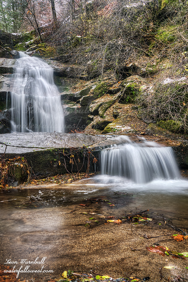
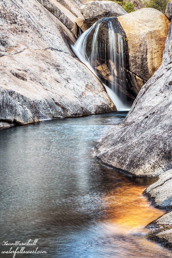
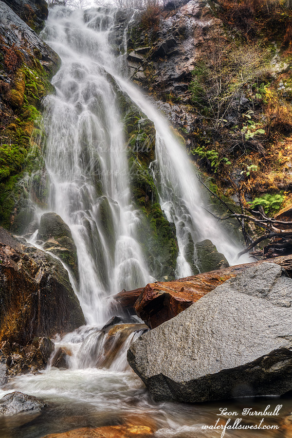
The flow was about perfect. If it is too high, you cannot even get to the lower falls. There is an extremely dangerous stream crossing just before the lower falls. It was all right today, but the rocks were wet and slick, so you need to be very careful. If you slip, you will go over a big waterfall and probably be dead. Needless to say, I was careful.
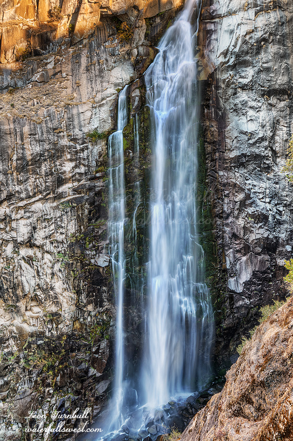
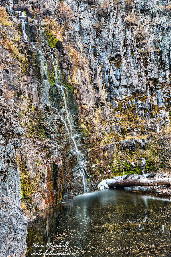
I had lots of time, so I took plenty of photos of the lower falls before beginning the big climb up to the upper falls. I climbed up high and then back down to the creek, eventually reaching the same point I got to last time. Last time I was here, I ran out of daylight and did not have time to get to the waterfall. Today I had plenty of time. I needed to cross the creek. It was almost but not quite rock hoppable, so I put on my water shoes to cross. I probably actually could have rock hopped it. Anyhow, better safe than sorry. Once on the other side, you just need to climb up the bank. There was oak here, but I think (I hope) I avoided touching it. Finally, I came into full view of the magnificent waterfall. I let out a huge whoop and holler. No one heard me. I could not believe I actually made it here. It seems so difficult and impossible from down at the highway. As far as I know, I am the first to make it here, and the first to document its discovery. It is another waterfall madman first encounter.
I measured the waterfall to be 113 ft. high (the lower falls is 67 ft. high). It is absolutely stunning, and you can get right up to it and touch it if you like. It is also difficult to photograph because of the spray. I took plenty of photos anyway, and spent a lot of time here enjoying the moment.By the time I got back to the car, it was noon. The sun was out. Time to eat lunch and drive home. It was a most awesome day in Plumas National Forest.